Best time to visit France

Col d'Izoard in France

An iconic high mountain pass featured in the iconic Tour de France race

Best time: mid-June–October

Col d'Izoard
Col d'Izoard
Col d'Izoard
Col d'Izoard
Col d'Izoard

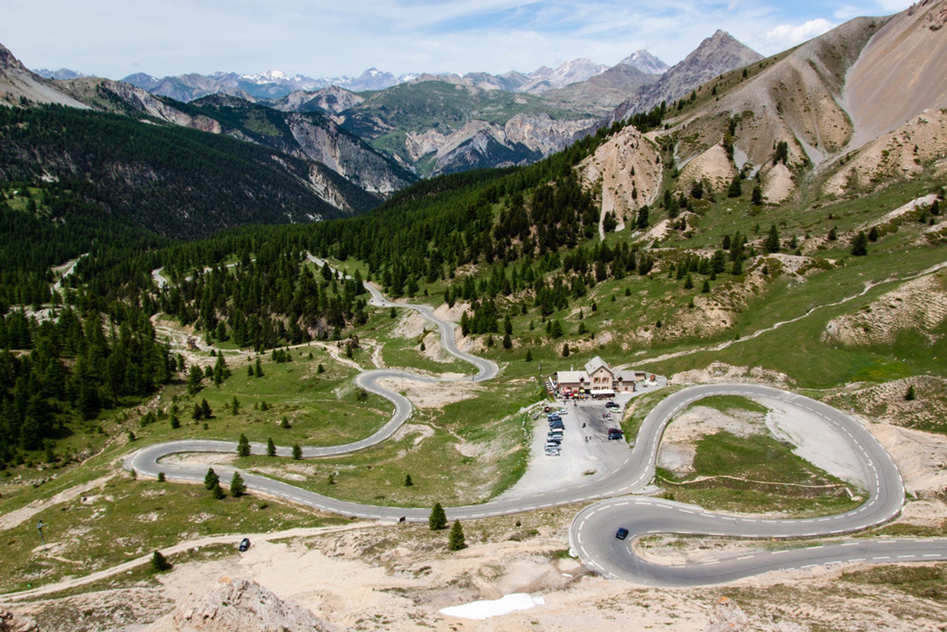
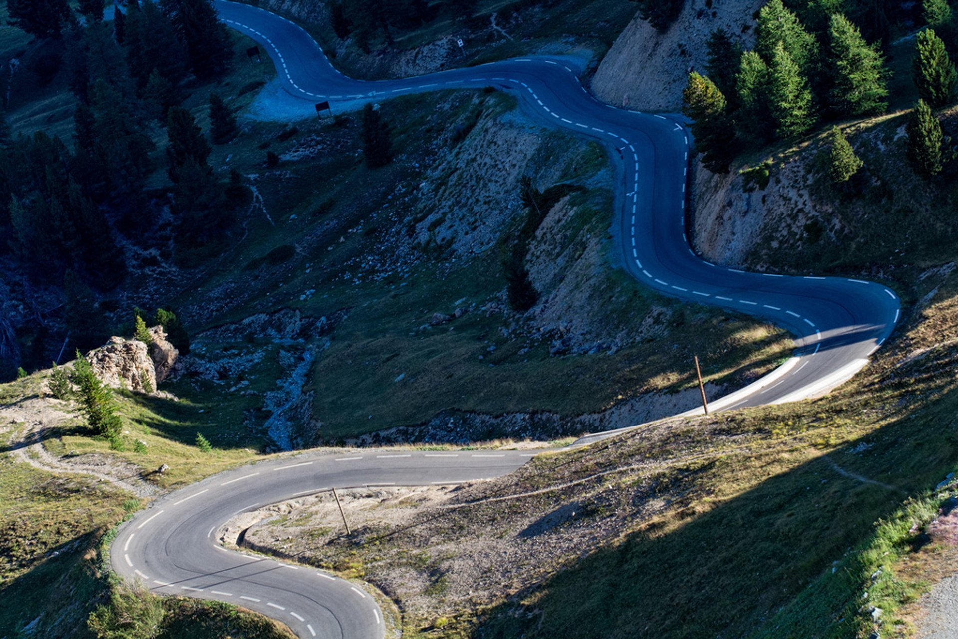
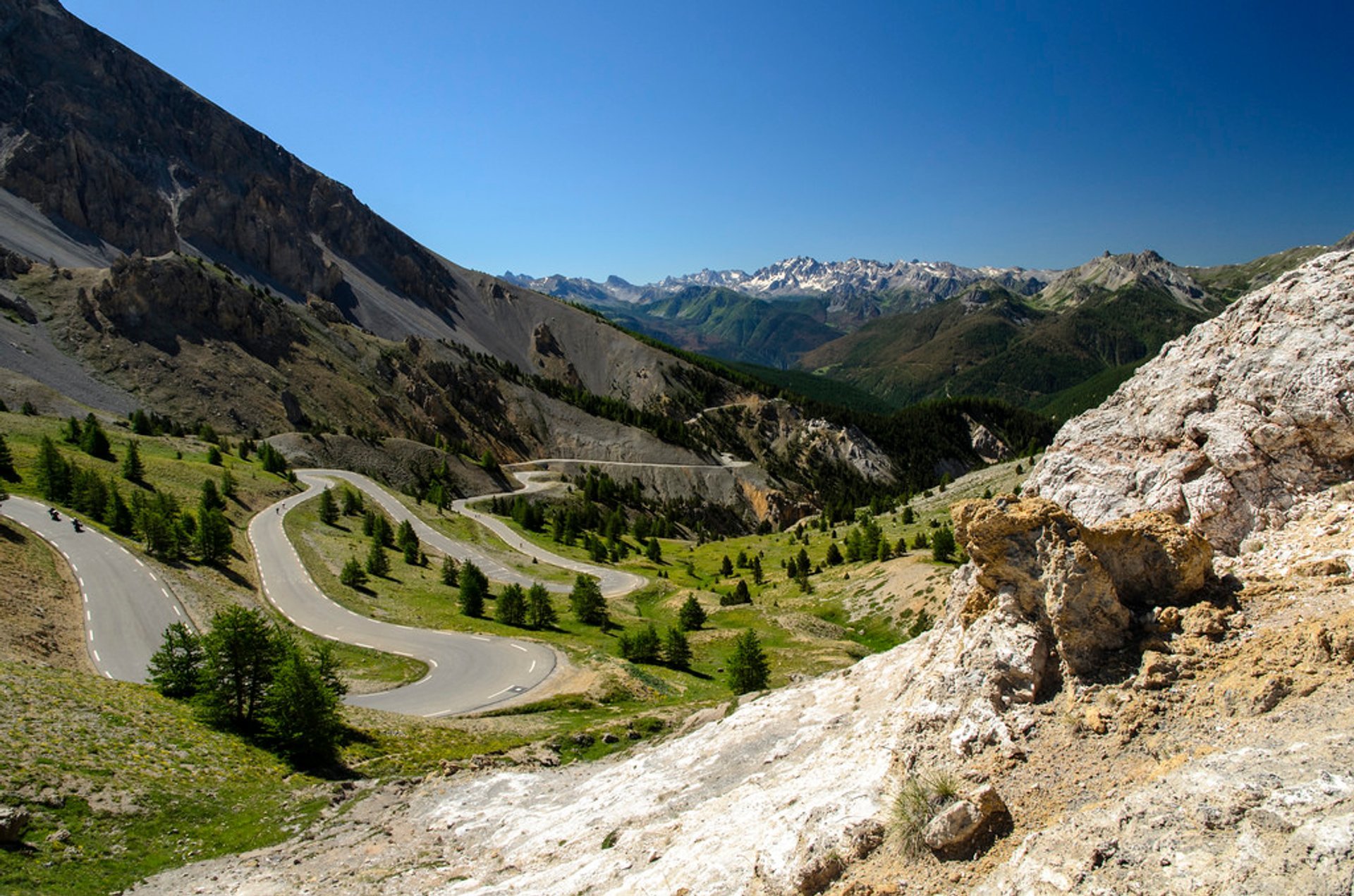
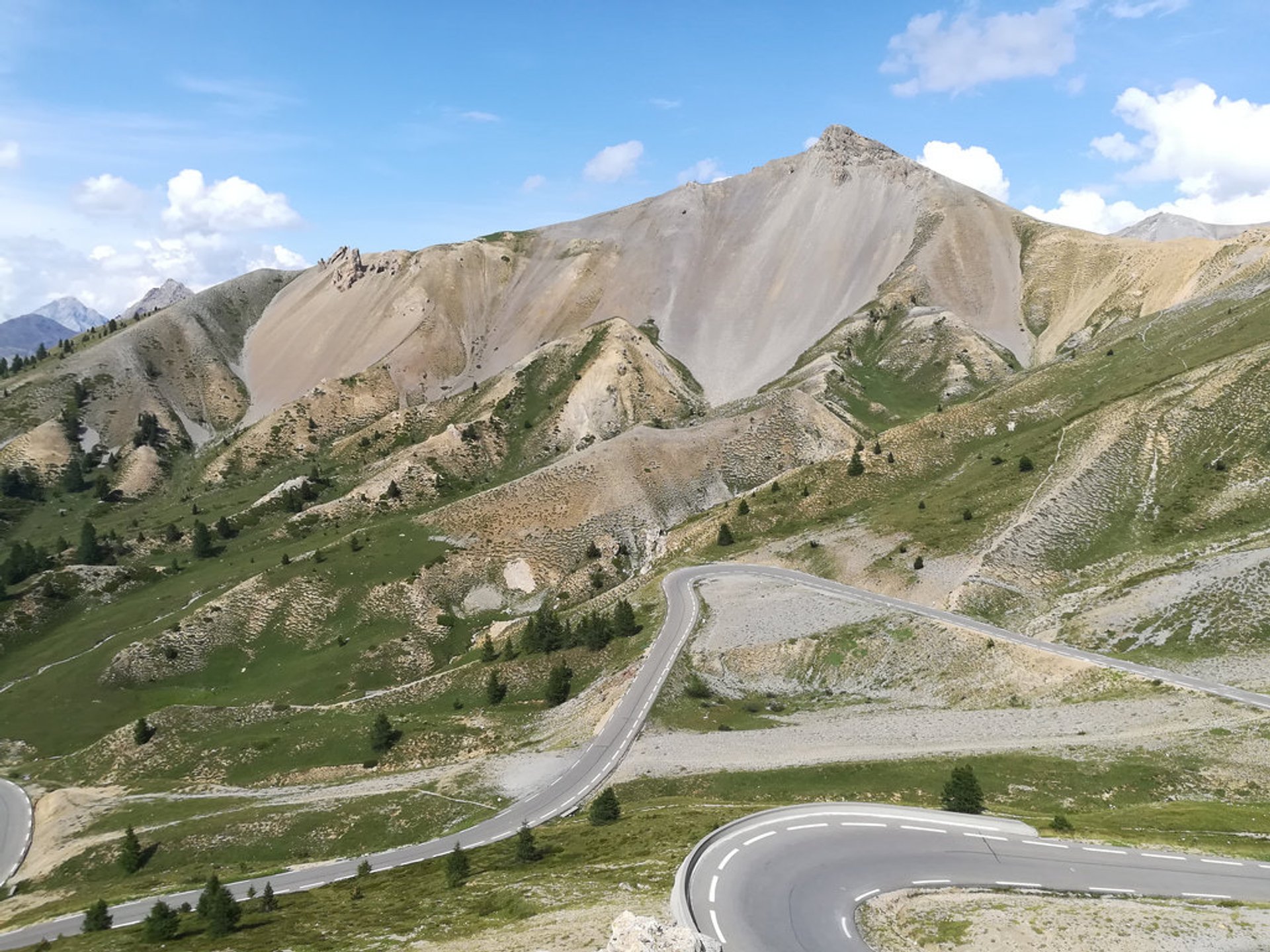
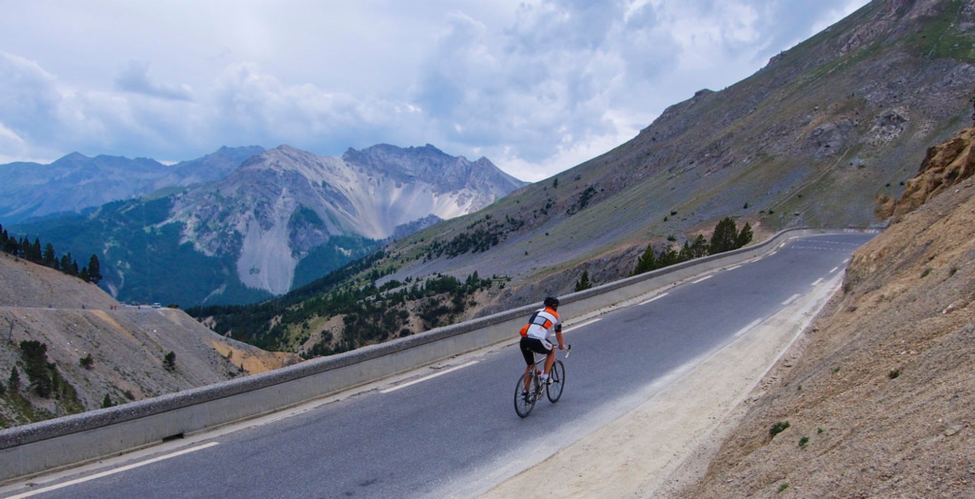
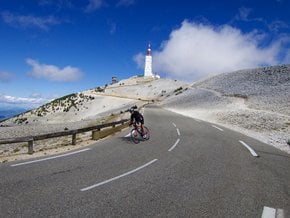
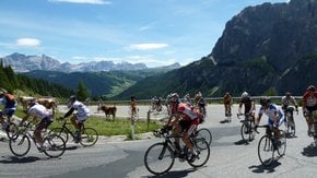
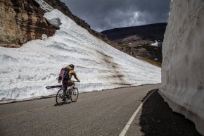
The Col d'Izoard is a legendary French Alps pass with an elevation of 2,360 m (7,746 ft). Located in Provence-Alpes-Cote d'Azur region, the scenic pass is traversed by Route des Grandes Alpes. D902 road, running over the pass, links Guillestre in the valley of the Guil on the south to Briançon on the north. This picturesque area is known as Casse Déserte, famous for dramatic Tour de France moments that took place along its curvy twists. Col d'Izoard witnessed the victory of Warren Barguil in 2017 Tour de France's Stage 18.

The road starts to climb for 31,5 km (20 mi) from Guillestre with a gradient of 4.8%. The road gains 1,095 m (3,593 ft) with gradient reaching 10% in some sections. If you go up from Briançon, you'll cover 19 km (11.8 mi) to reach the top gaining 1,105 m (3,625 ft) of elevation with a maximum gradient of 8.9%. The road is closed every year for winter roughly from November to mid-June. For the road closure updates, please check local websites to plan accordingly.

Besides motorized vehicles, the road is also popular among cyclists. You'll find kilometer markers info on gradient and altitude—a sure sign you are in a cycling country.

There is a small bar on the summit and a cycling museum. About 2 km south from the top there’s a monument to legendary cyclists Fausto Coppi and Louison Bobet. Visitors will also be rewarded by magnificent Casse Deserte scenery.

Practical info

When is the best time to visit Col d'Izoard?

The French Alps' harsh weather conditions close the road from November until mid-June. Mid-June to October is the best time to visit Col d'Izoard because the weather is pleasant. The route is ideal for travelers who love scenic beauty, as the pass offers the most picturesque landscape and scenic view. Show more

Where is Col d'Izoard located?

Col d'Izoard lies in the beautiful French Alps, in the Provence-Alpes-Cote d'Azur region, traversing the Route des Grandes Alpes. The pass's location along D902 road, near Casse Déserte, offers accessibility to tourists visiting the Guillestre in the valley of the Guil or Briançon on the north, near the border with Italy. Show more

What is the length and gradient of the road to reach Col d'Izoard from Guillestre?

The road to reach the summit of Col d'Izoard from Guillestre is 31.5 km (20 mi) long and has a gradient of 4.8%, with a section reaching up to 10%. The road gains 1,095 m (3,593 ft) of elevation. Though the journey takes up to three hours, visitors can enjoy picturesque scenery offered along the way. Show more

Are there any facilities on top of Col d'Izoard summit?

On the summit of Col d'Izoard, visitors can drink in the view of the magnificent panoramic Casse Deserte scenery. The summit also houses a small bar where tourists can grab a drink and a cycling museum. Additionally, there is a monument to cyclists Bobet and Coppi located about 2km south of the top. Show more

Why is Col d'Izoard famous among cyclists?

One of the several routes cycling enthusiasts love is the famous Col d'Izoard. Featured in the Tour de France, the pass's challenging route with kilometer markers indicating gradient and altitude is a sign that you are cycling in the right country. Cyclists worldwide visit the pass to experience its steep roads and enjoy the scenic beauty of the pass at the same time. Show more

Ask a question

Find hotels and airbnbs near Col d'Izoard (Map)

Last updated: