Best time to visit Seattle

Hidden Lake Lookout in Seattle

One of the best hikes in the Northwest

Best time: July–October

Hidden Lake Lookout
Hidden Lake Lookout
Hidden Lake Lookout
Hidden Lake Lookout
Hidden Lake Lookout
Hidden Lake Lookout
Hidden Lake Lookout

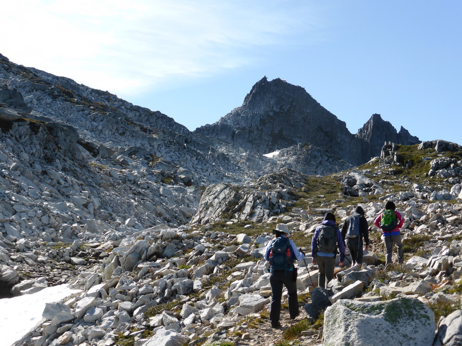
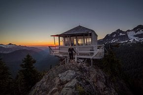
North Cascades National Park in the state of Washington has many scenic hiking trails. Hidden Lake Lookout day-hike is one of the most significant one-day options in the park. The path, located near Diablo, Washington, is 7.3 mi (11.74 km) long with 3,369 ft (1 026 m) of elevation gain. It is quite popular during the summer hiking season, which starts here in July since dangerous snow-filled gullies can be still present at the trail even in early summer.

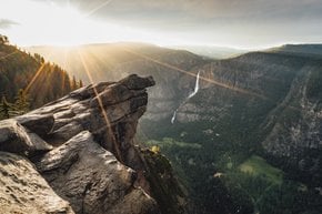
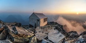
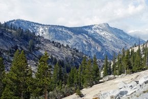
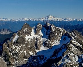
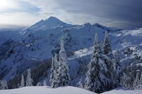
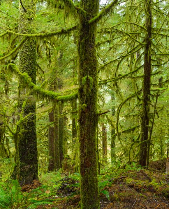
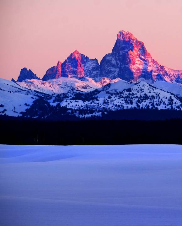
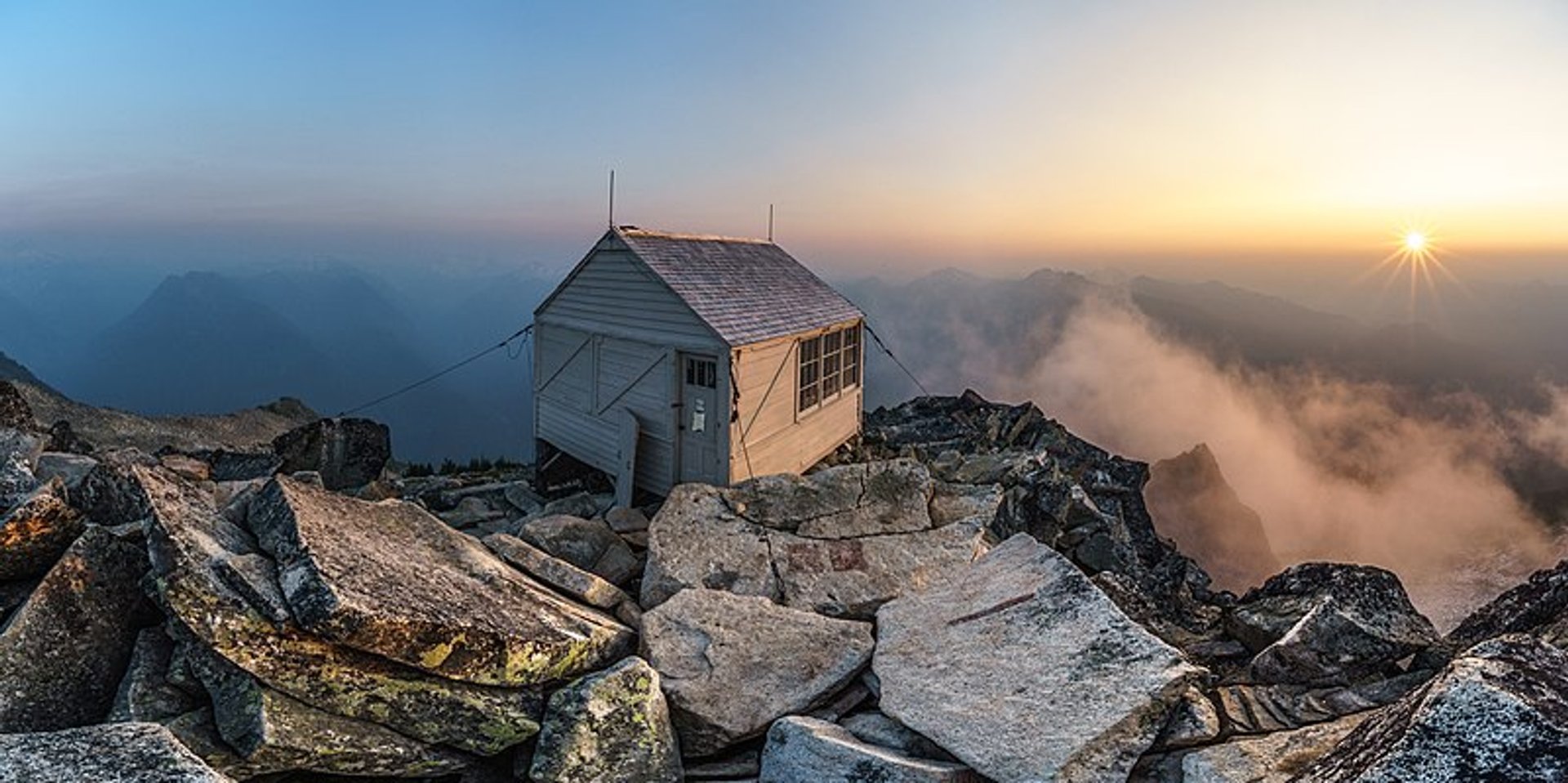
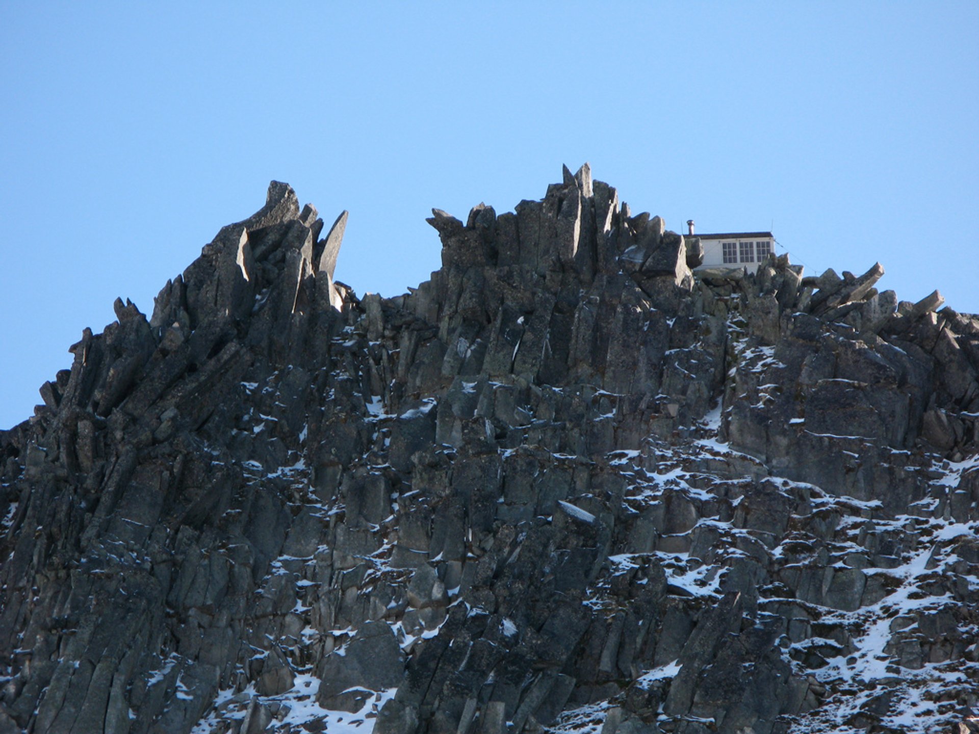
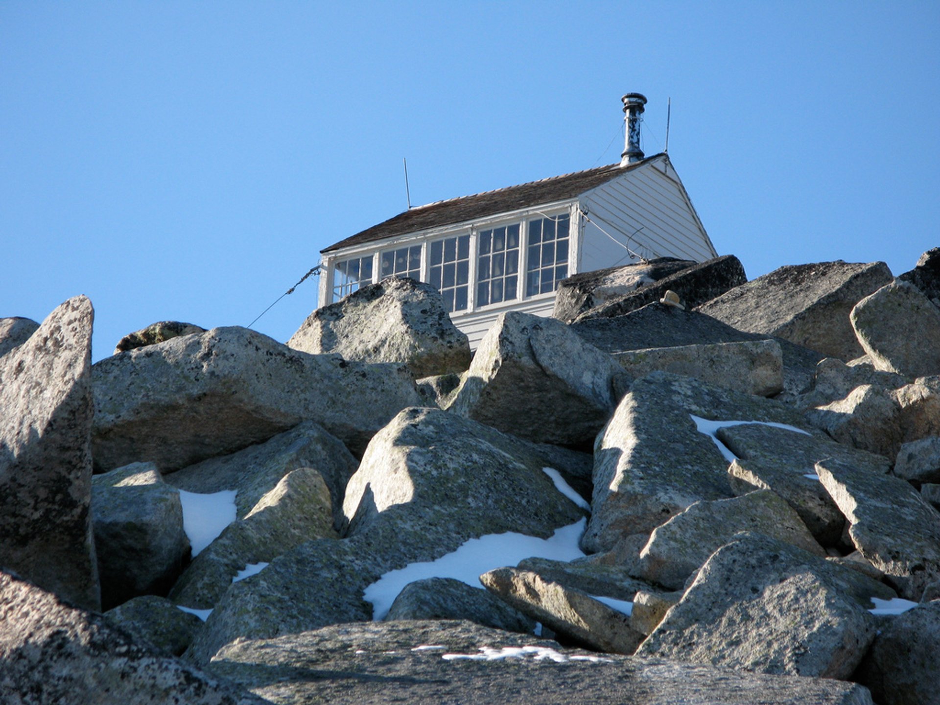
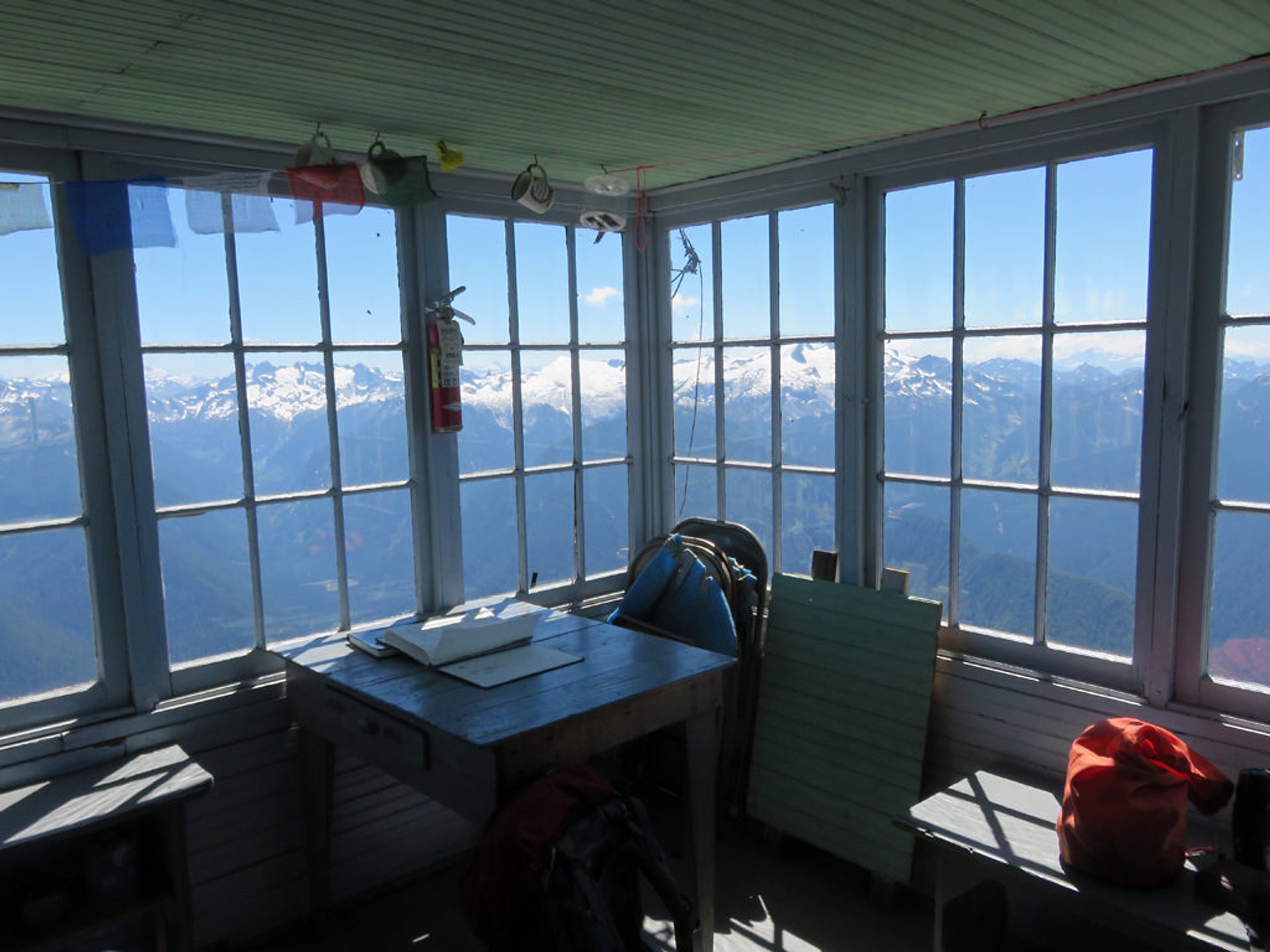
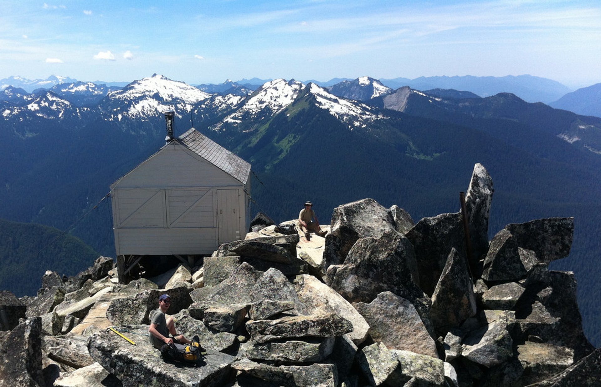
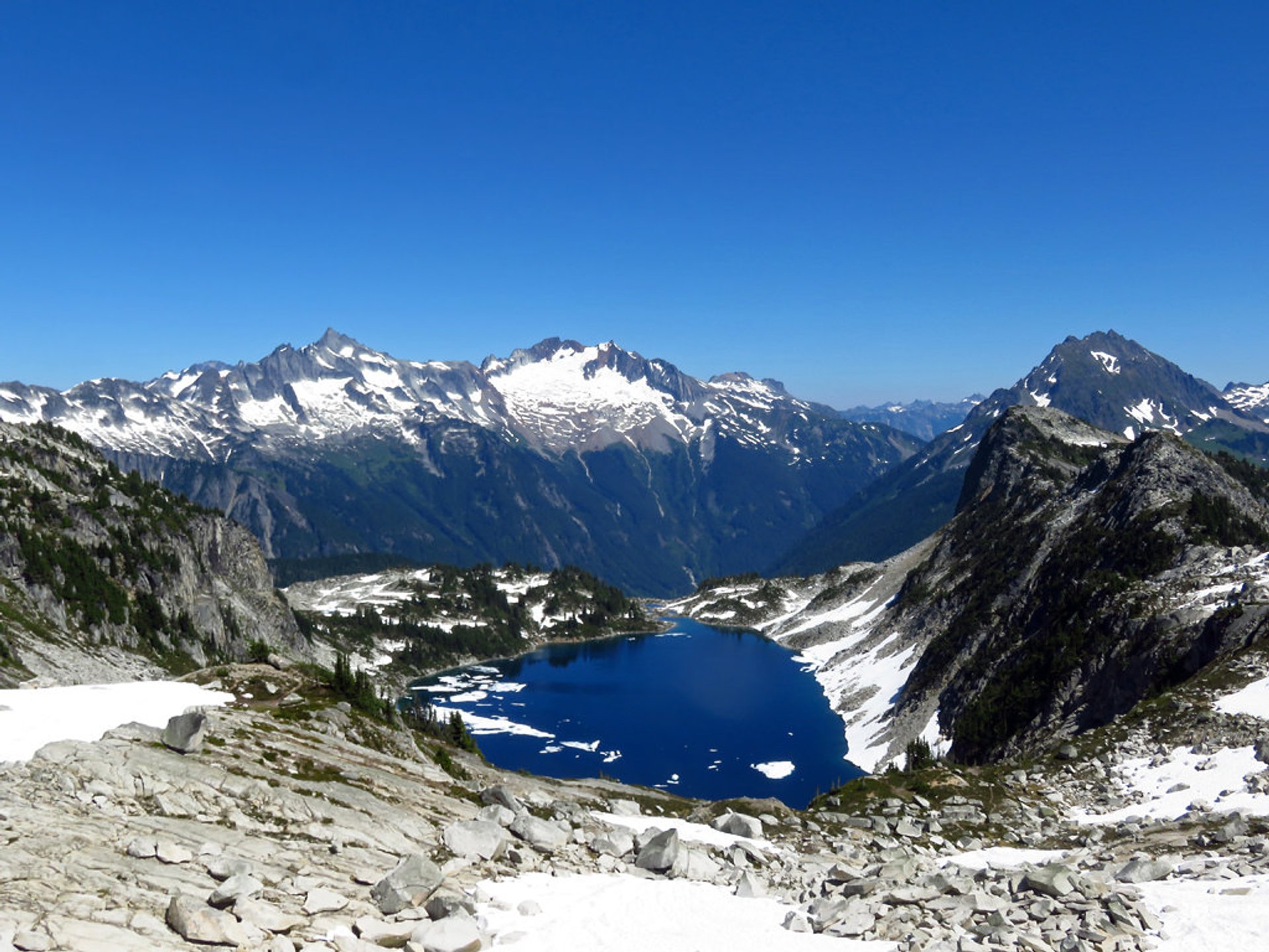
While walking the trail to Hidden Lake Peaks, hikers can see lush meadows blooming with wildflowers, large granite boulders perfect for sunbathing, and beautiful alpine nooks. The trail traverses East Fork Sibley Creek and provides excellent views of Mount Baker. At 4.2 mi (6.75 km) of the trail, hikers get to a 6,600-ft (2 011-m) point between Hidden Lake Peaks and other mountains. Summits like Eldorado, Forbidden, and Boston surround the Hidden Lake that is just below. The famous lookout cabin was built there in 1931.

Before hiking this trail check the North Cascades National Park website for snow and other conditions or stop at the rangers station in Marblemount.

Practical info

When is the best season to hike Hidden Lake Lookout in Seattle?

July to October is the ideal period for hiking Hidden Lake Lookout; it's the summer season that makes the hike accessible. However, early in the season, there are snow-filled trails, mainly requiring crampons for safety. The trail's website or the park ranger can offer information on snow condition, weather, and other necessary details before starting the hike. Show more

Where is the Hidden Lake Lookout trail located in North Cascades National Park?

The Hidden Lake Lookout trail is situated inside North Cascades National Park, close to Diablo, Washington. Accessing the trailhead involves driving along the North Cascades Highway also known as the State Highway 20, heading eastward. The entrance to Hidden Lake Peaks trailhead is Mile Post 148, a parking lot located just before the road ends, and the trail starts from that point. The starting point measures 3,100 feet (945 meters). Show more

What elevation gain should I expect during the hike?

Hiking the Hidden Lake Lookout trail requires significant physical effort due to the trail's challenging terrain, which ascends 3,369 feet (1,026 meters) to the peak. The beginning elevation is already 3,100 feet (945 meters), so cover 3.6 miles (5.79 km) to reach the 6,100 feet (1,860 meters) peak. For most hikers, completing the hike within 4.5 hours is suitable, but the physical fitness level and exposure may affect the duration. Show more

What is the view from the Hidden Lake Lookout?

Experience the crystal-clear beauty of North Cascade mountain range by hiking and taking in the panoramic rocky scenery at the Hidden Lake Lookout. The peak provides stunning panoramic views, and it is possible to sightsee Diablo Lake, Logan, Sahale, Baker, Eldorado, and Forbidden peaks. While hiking, you can also enjoy the surrounding natural beauty of wildflower meadows, crystal blue Hidden Lake and a lookout cabin that offers magnificent shots of its gorgeous surroundings. Show more

Are there any safety precautions I need to take before hiking the Hidden Lake Lookout trail?

Before beginning the hike on the Hidden Lake Lookout trail, it's vital to prioritize your safety. Acquire trail knowledge using a guide or map, check the weather forecast, and inform friends or family of your itinerary. Carrying sunglasses, sunscreen, headlamp, at minimum 2 liters of water, and first aid kit, emergency blanket, and extra clothing, and hiking boots is essential. Additionally, wear bug bites repellent and check the park website for up-to-date covid-19 alerts and guidelines. Show more

Ask a question

Find hotels and airbnbs near Hidden Lake Lookout (Map)

Last updated: by Eleonora Provozin