Flooded Bonneville Salt Flats in Utah 2025-2026
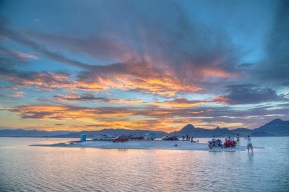
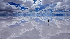
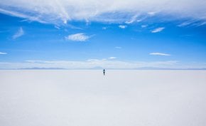
This unique and stunning landscape attracts visitors from all over the world to experience the unforgettable 'mirror effect'
Best time: November–May
The Bonneville Salt Flats, located in northwestern Utah, are a striking natural wonder famous for their vast, otherworldly expanse of hard, white salt crust. Formed over 10,000 years ago from the remnants of the ancient Lake Bonneville, this unique landscape spans approximately 30,000 acres. Known for its serene beauty and reflective qualities when flooded, the salt flats are a favorite destination for photographers, adventurers, and those seeking a surreal escape. Its popularity also stems from its role as a testing ground for world land speed records.
Flooded vs. Dry Salt Flats
The Bonneville Salt Flats offer two distinct experiences: flooded during late winter and early spring, and dry in summer and fall. When flooded, the flats transform into a massive natural mirror, creating breathtaking reflections of the sky. In contrast, the dry season reveals a cracked, otherworldly surface, perfect for land-speed racing and off-road exploration. Each season highlights a different aspect of the flats’ beauty, captivating visitors year-round.
When to See the Flooded Salt Flats
The best time to witness the flooded Bonneville Salt Flats is from late winter through early spring, typically January to March. During this period, melting snow from nearby mountains fills the flats with a shallow layer of water, creating a surreal reflective surface. Visitors can expect ethereal sunrises, colorful sunsets, and an almost magical quality to the landscape that feels like stepping into another world.
The surface breaks easily under the weight of a vehicle, especially during the wet season, when it becomes softer. There were accidents when drivers got stuck in the mud beneath the salt, some of those unfortunate accidents were lethal. That's the main drawback of the season—you can only walk across the flats, as vehicles aren't allowed in the area. Still, people come during wet months to see two skies, one above and the other beneath.
Also, note that in winter months the air temperature may easily drop below zero. Overnight stays are forbidden in the area, and campsites are available only on surrounding public lands.
Things to Do at the Flooded Salt Flats
Hiking along the edges of the flooded flats offers a unique way to explore the area, with opportunities to observe the interplay of water and salt. Photography is a favorite activity, as the mirror-like surface amplifies light and colors, resulting in stunning images. While some people are drawn to the idea of kayaking along the shallow canals, this activity is prohibited, as it can harm the delicate ecosystem and disrupt the natural setting.
Getting There from Salt Lake City
The Bonneville Salt Flats are about a 90-minute drive west of Salt Lake City. To reach them, take Interstate 80 west toward Wendover and exit at the Bonneville Speedway or rest area signs. From there, follow the signs to the flats, ensuring a smooth journey to one of Utah’s most iconic destinations.
Geological Marvel of the Bonneville Salt Flats
In 1985, the Bonneville Salt Flats was designated an Area of Critical Environmental Concern due to its unique geology and beauty. The flats are a remnant of the prehistoric Lake Bonneville, which once covered much of the Great Basin. As the lake evaporated, it left behind a dense layer of salt, creating the flats we see today. This unique geological formation is an important natural and historical site, with its layers preserving clues to the region's ancient climate and environment.
Visiting the Bonneville Salt Flats, whether flooded or dry, offers a glimpse into nature’s artistry, blending serene beauty with geological significance. It’s a must-see destination for anyone exploring Utah’s vast landscapes.

