Monticello Dam Morning Glory Spillway in California 2025-2026
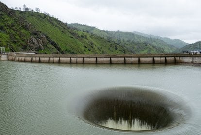
An enormous drain hole that resembles a portal to another world is especially impressive during the rainy season
Best time: November–March
The Monticello Dam Morning Glory Spillway, often referred to as the "Glory Hole" by locals, is a fascinating engineering marvel located in Napa Valley, California. Situated within the Monticello Dam on Lake Berryessa, this spillway is known for its unique design and functional purpose of regulating water levels.
What is the Morning Glory Spillway?
The Morning Glory Spillway is a drop-inlet structure designed to manage excess water in Lake Berryessa, preventing flooding and ensuring the safety of the Monticello Dam. When the lake's water level surpasses 440 feet, water flows into the spillway, a massive funnel-like opening measuring 72 feet (22 m) in diameter at its widest point. The water then plunges 200 feet (61 m) vertically, narrowing to 28 feet (8.5 m) before exiting into Putah Creek and eventually into the Yolo Bypass. The structure operates automatically, creating an impressive sight when active, especially during periods of heavy rainfall.
What to Expect
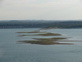
While the Morning Glory Spillway itself is cordoned off for safety reasons, it can be viewed from nearby roads or the parking area adjacent to the dam. Visitors often come to marvel at its scale and design, especially when water is flowing through the spillway. Surrounding the spillway, Lake Berryessa offers picturesque views, particularly in spring when water levels are higher and the landscape is lush from recent rains.
During drier seasons or periods of normal rainfall, the Morning Glory Spillway at the Monticello Dam stands with a low water level. In this state, it appears as a large, circular concrete structure rising prominently from the surrounding terrain. Without water flowing into it, the Glory Hole resembles an empty funnel on dry land, blending into the rocky environment and lacking the dramatic effect of cascading water. This is the typical view of the spillway, making it less visually striking than during times of active water flow.
Accessibility and Practical Information
There is no visitor center or significant signage at the Monticello Dam site, so visitors should come prepared with necessary supplies, including water and snacks. A small, dusty parking area is available near the dam. For safety purposes, fencing around the spillway restricts close-up photography, but visitors can still capture impressive views of the spillway and the lake from various angles. It's important to note that the dam is strictly for viewing only, and swimming is not permitted.
Location and Nearby Attractions
The Monticello Dam, located at the eastern boundary of Napa County where Putah Creek forms Lake Berryessa, is a primary attraction for visitors interested in the impressive spillway and dam. The surrounding area offers additional attractions, such as Lake Berryessa, which is popular for boating, fishing, and picnicking. Putah Creek is known for its serene trails and excellent birdwatching opportunities. Additionally, the renowned vineyards of Napa Valley are within driving distance, providing delightful wine-tasting experiences.
A Brief History of the Monticello Dam
Completed in 1957 by the Bureau of Reclamation, the Monticello Dam was constructed to create Lake Berryessa as a reservoir for agricultural and municipal use. The Morning Glory Spillway, a unique and singular drainage system shaped like a funnel, was incorporated into its design to address space constraints and utilize the site's sturdy rock foundation. The spillway became active for the first time in 10 years during the 2017 California floods, an epic sight that returned in 2019 after a series of storms hit northern California.

