Danakil Depression in Ethiopia 2026-2027
Visit the 'Mars on Earth' at the meeting point of three tectonic plates in northeastern Ethiopia
Best time: November–February
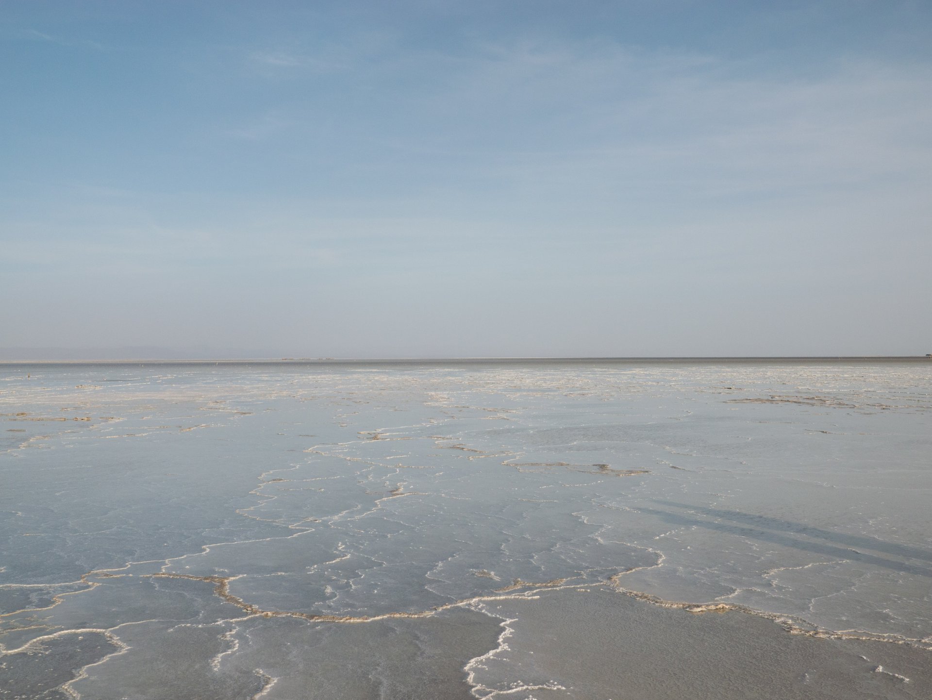
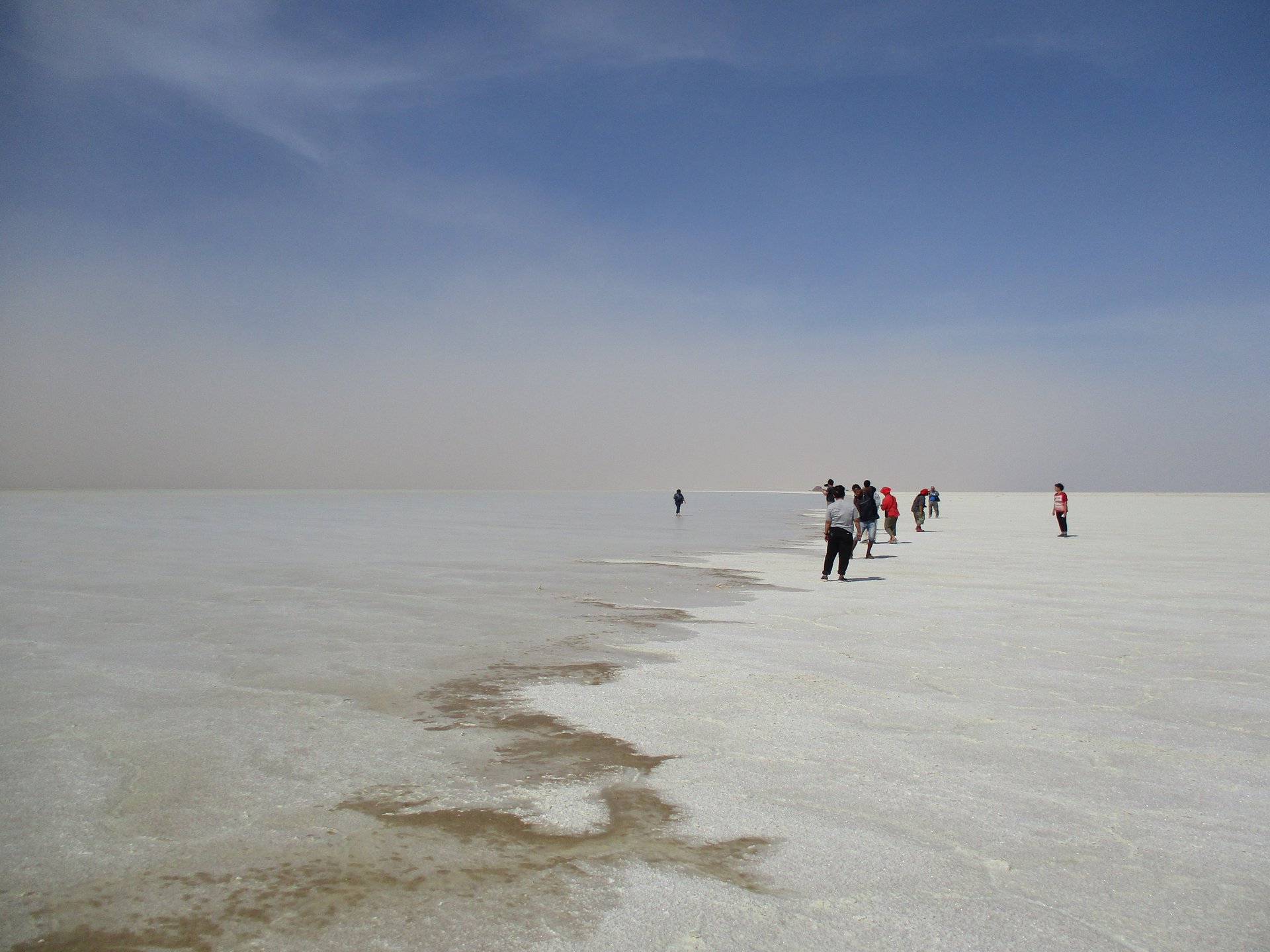


The Danakil Depression, the hottest place on Earth by year-round temperature, is a striking landscape of vast plains, colorful rock formations, and steaming hot springs. Formed by the separation of three tectonic plates, it lies in northeast Ethiopia near the borders of Djibouti and Eritrea. Spanning 200 by 50 km (124 by 31 mi), it includes Africa’s lowest point at 125 meters (410 feet) below sea level.
Best Time to Visit
The best time to visit the Danakil Depression is from September to May when daytime temperatures are more manageable at 35-40°C (95-104°F). However, the ideal months are November to February, when conditions are milder and less dry.
Getting there
The Danakil Depression remained largely unvisited until recent years when improved access and high-profile documentaries increased its popularity. Today, thousands of tourists visit this remote yet stunning region. The main access point is Mekele, a town well-connected by Ethiopia’s domestic flight network, with direct flights from Addis Ababa and northern cities like Gondar, Lalibela, Axum, and Bahir Dar. Travelers coming from the south, such as the Bale Mountains or Omo Valley, must connect through Addis. From Mekele, guided tours depart in sturdy Toyota Land Cruisers for a 3-4 hour journey into the Danakil, transitioning from asphalt roads to rugged lava fields. After the excursion, visitors typically return to Mekele, where they can catch an evening flight or stay overnight before continuing their travels.
Key Places
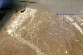
Dallol
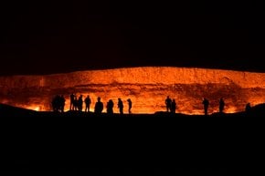
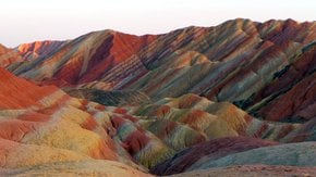
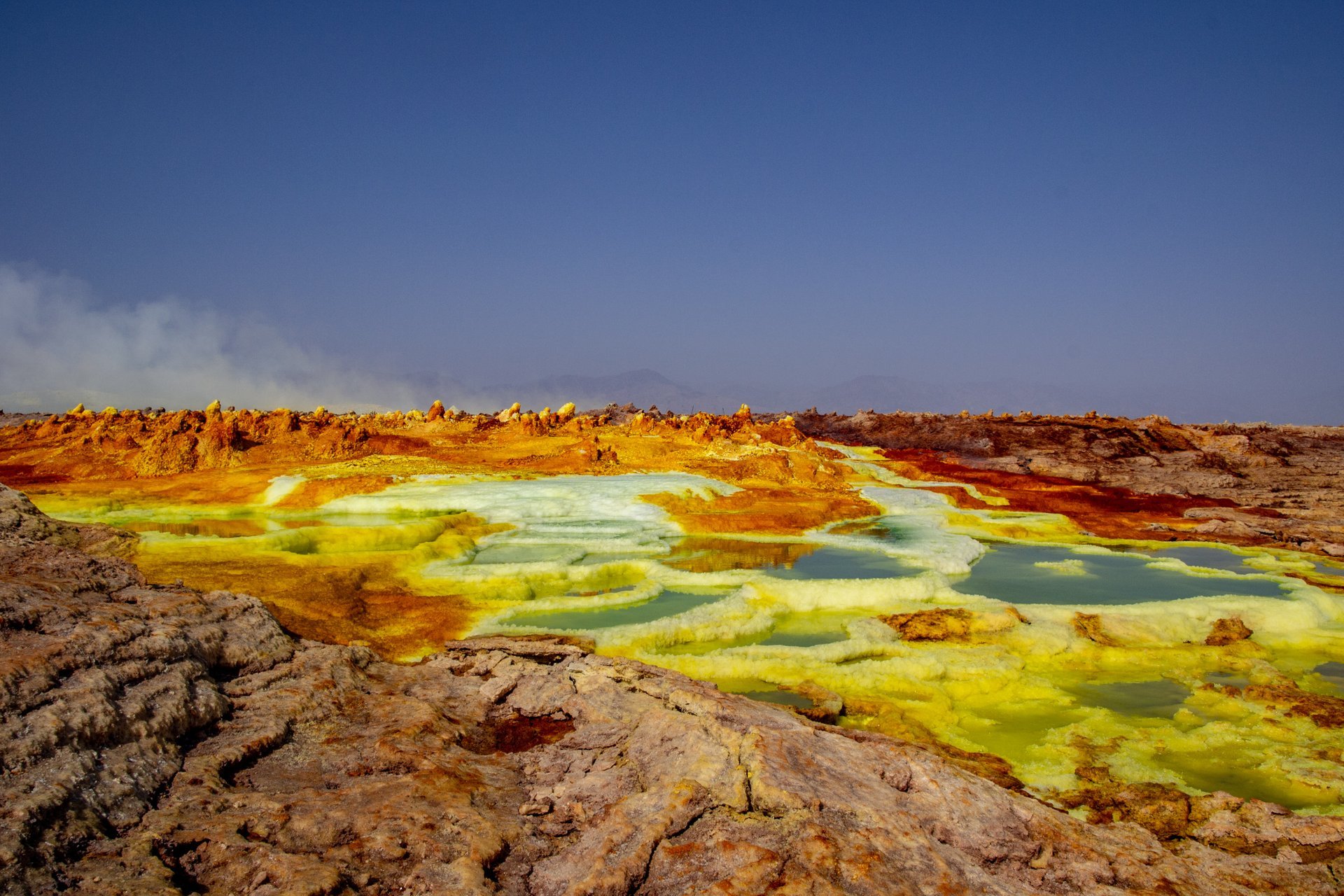
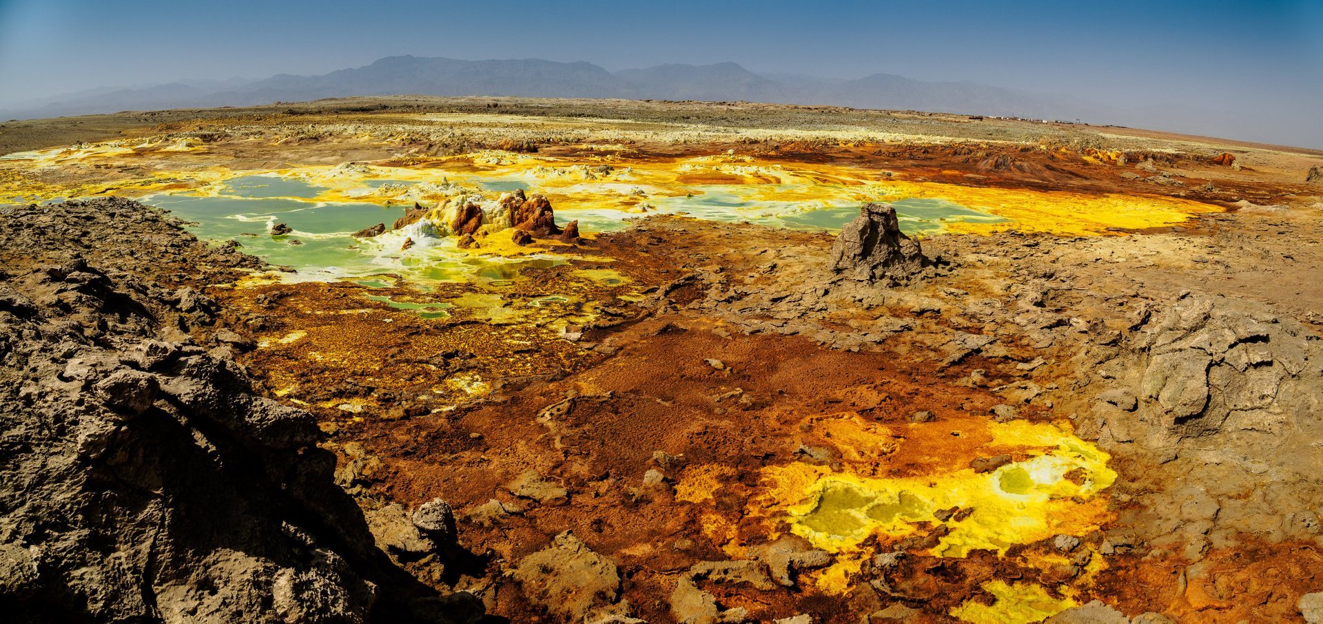
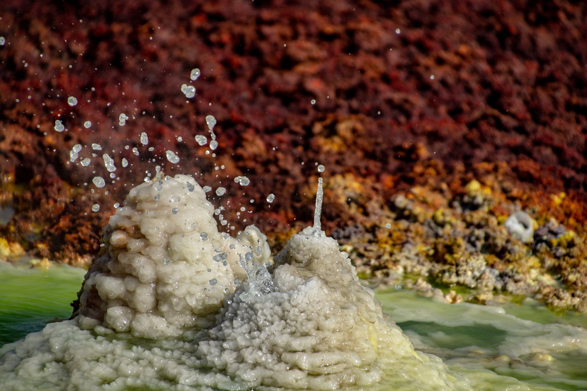
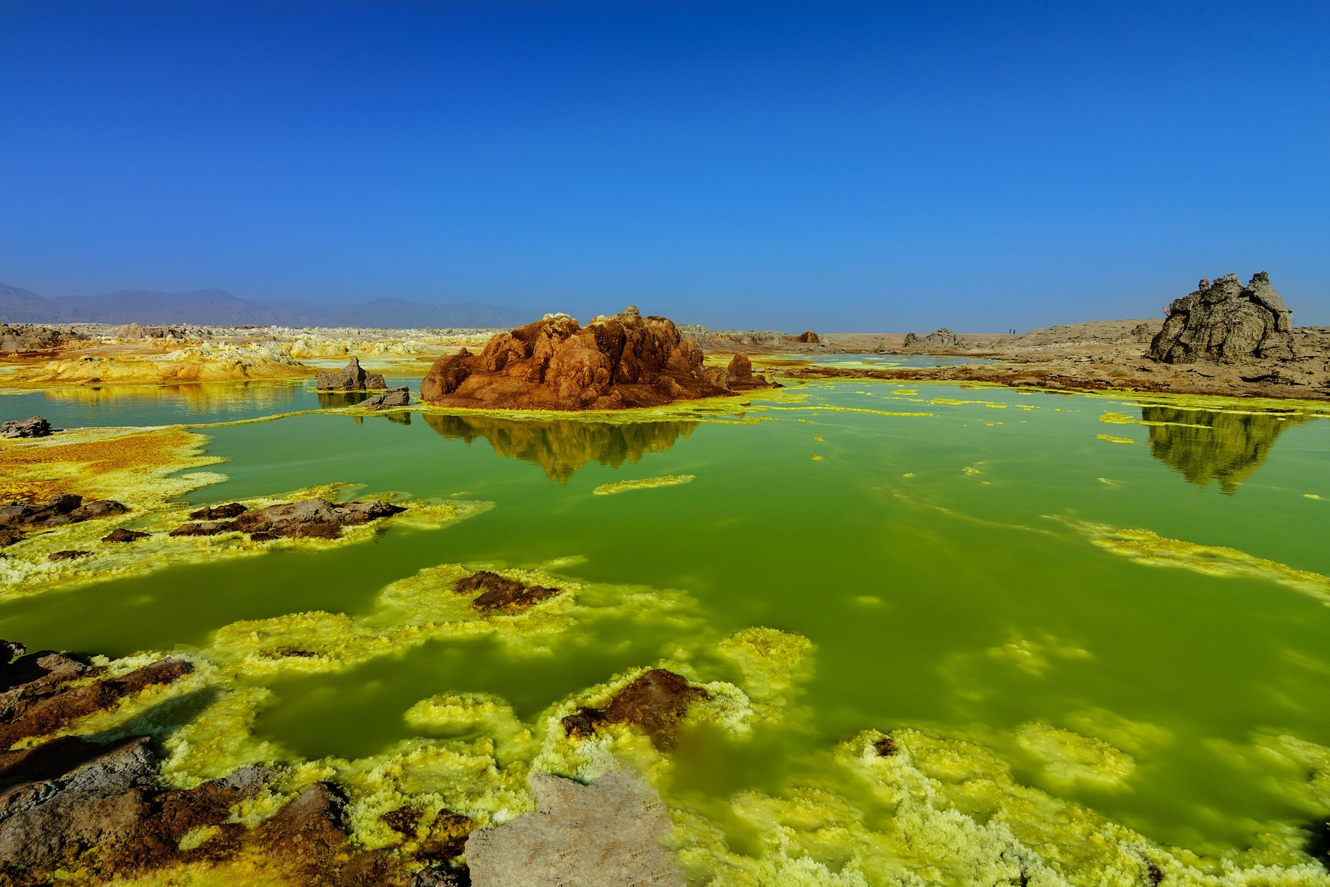
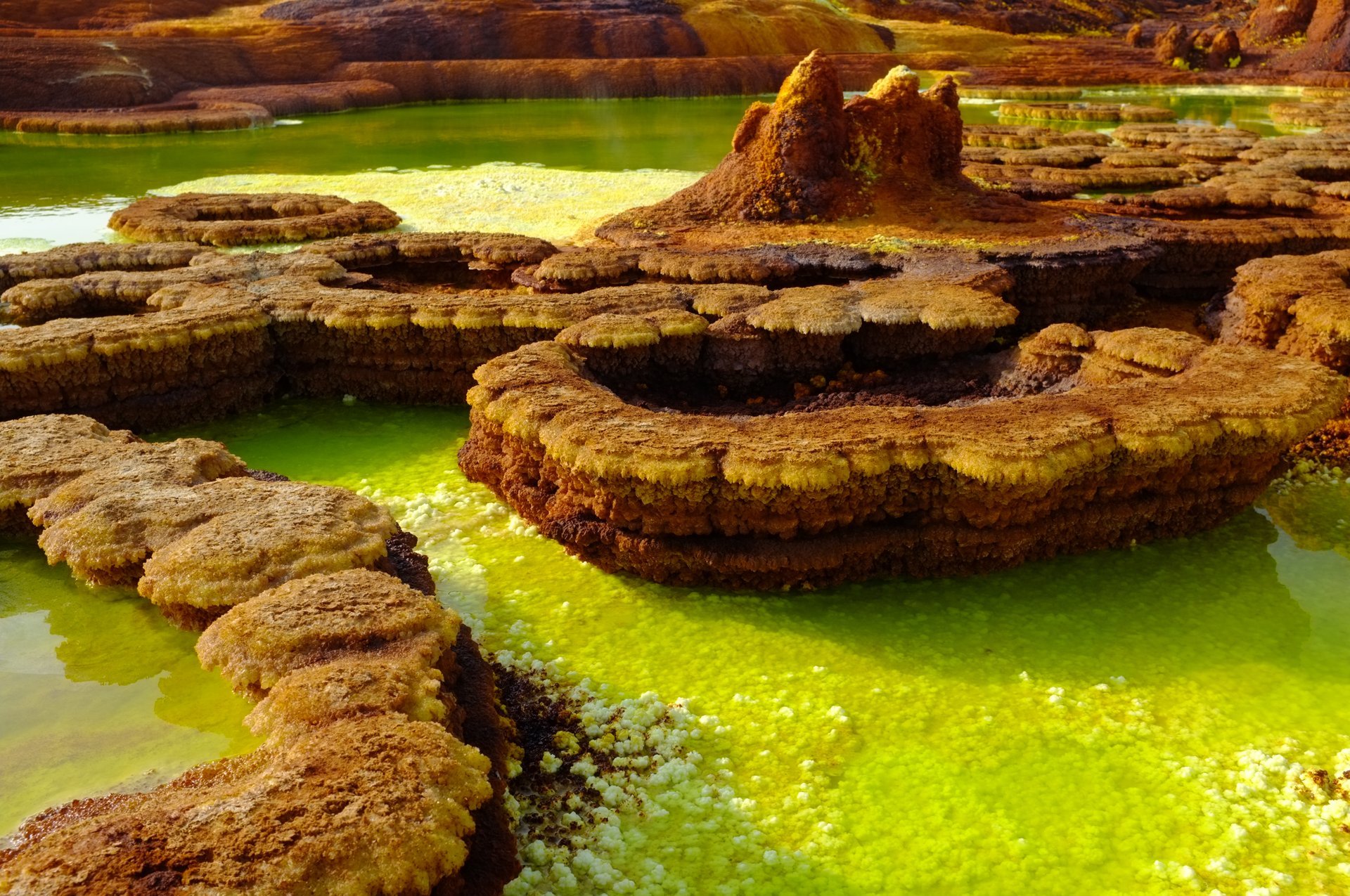
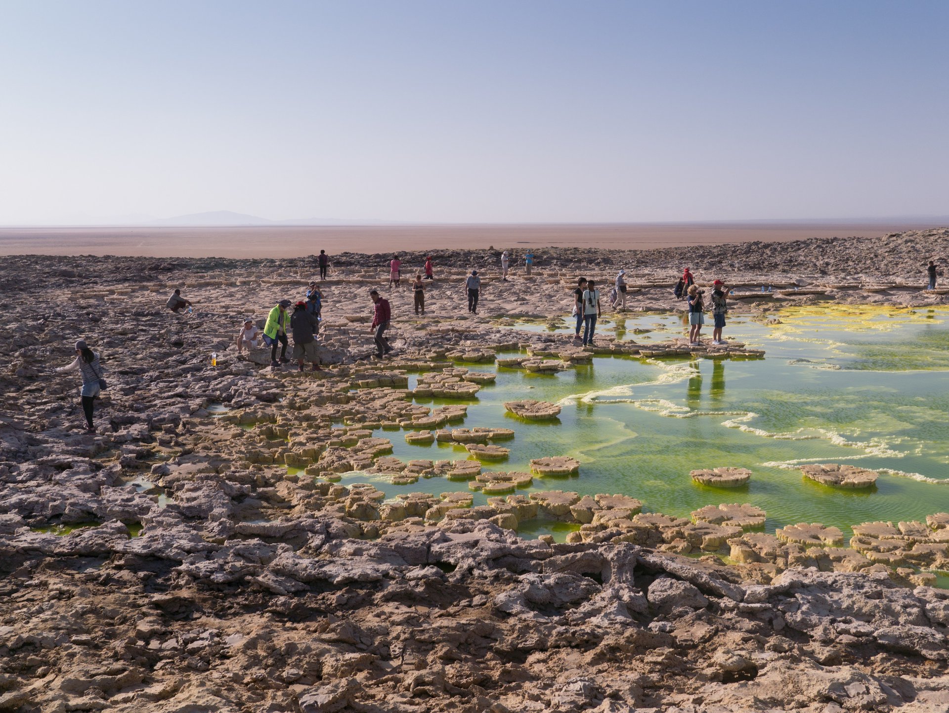
Visitors to the Danakil Depression are drawn to the surreal landscape of Dallol, a cinder cone volcano northeast of the Erta Ale Range. Resembling Yellowstone National Park, this otherworldly site features hot springs filled with brine and acidic liquids, as well as towering sulfur and salt formations. The Dallol crater, 48 meters below sea level, is one of the world’s lowest volcanic vents, surrounded by gas geysers and acid pools, creating a visually stunning and geologically unique environment.
Volcano
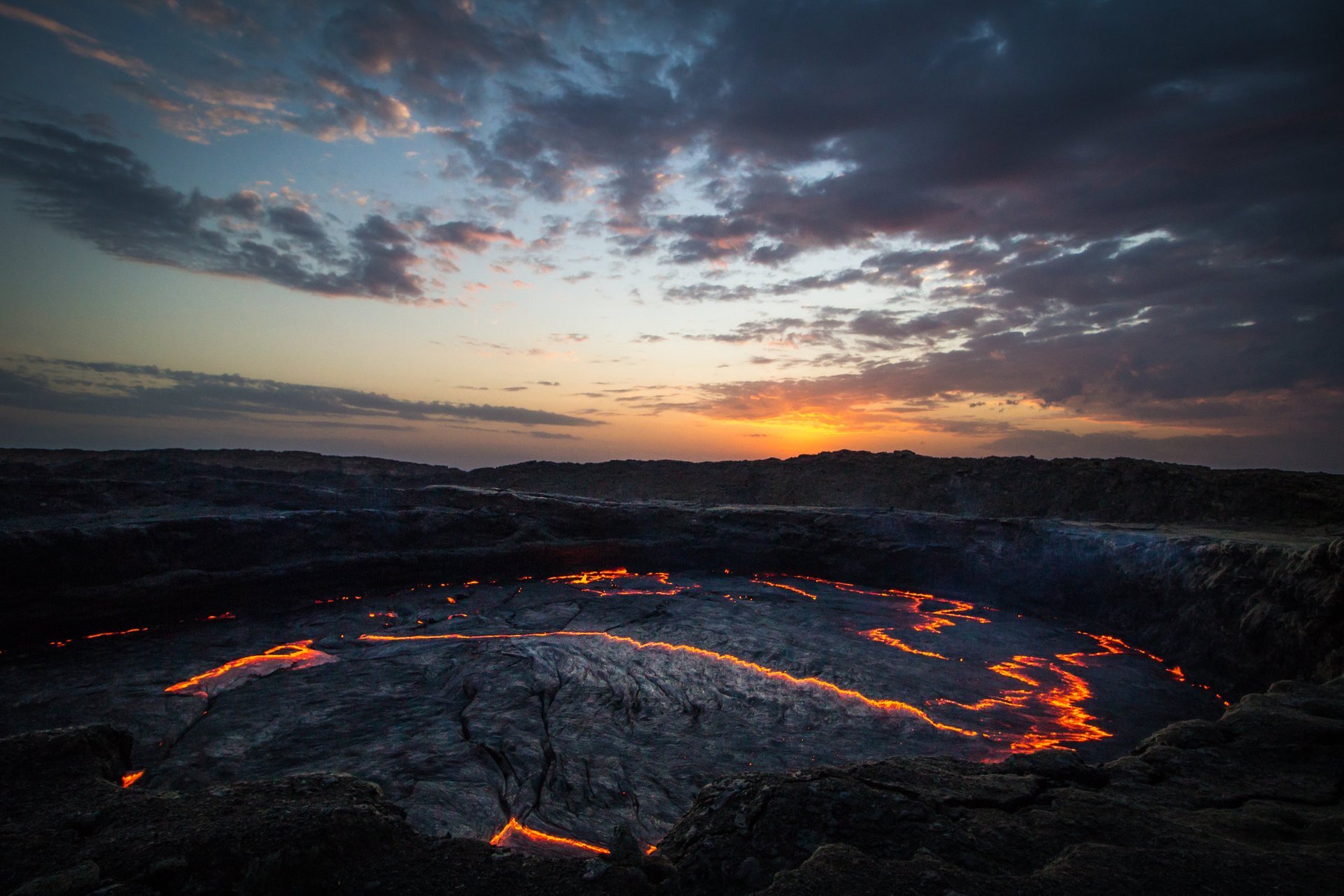
Other must-visit sites include Erta Ale, Ethiopia’s most active volcano, which houses one of the planet’s few permanent lava lakes. The glowing molten lava set against intense heat is an awe-inspiring experience. The hypersaline lakes of Karum (Asale) and Afrera (Afdera) add to the region’s striking scenery, making the Danakil Depression one of the most visually and scientifically fascinating places on Earth.
Guided Yours
Tour prices to the Danakil Depression vary based on duration, group size, and services included. A 7-day tour from Addis Ababa, covering Erta Ale and Dallol, costs around $2,500 per person for two people. Prices for shorter 3-4 day tours starting from Mekele typically range between $500 and $900 per person, depending on group size and comfort level. These tours generally include transportation, guides, meals, accommodation, and security escorts.
Weather & History
With year-round temperatures averaging 34°C (reaching up to 50°C in summer) and minimal rainfall of about 100 mm annually, the Danakil Depression is one of the most extreme environments on Earth. Lying 125 meters below sea level, it has drawn geologists and paleoanthropologists since the discovery of the 3-million-year-old Australopithecus fossil "Lucy" in 1974. The region's last volcanic eruption occurred in 1926, and the now-abandoned village of Dallol was once a hub for mining potash, sylvite, and salt.
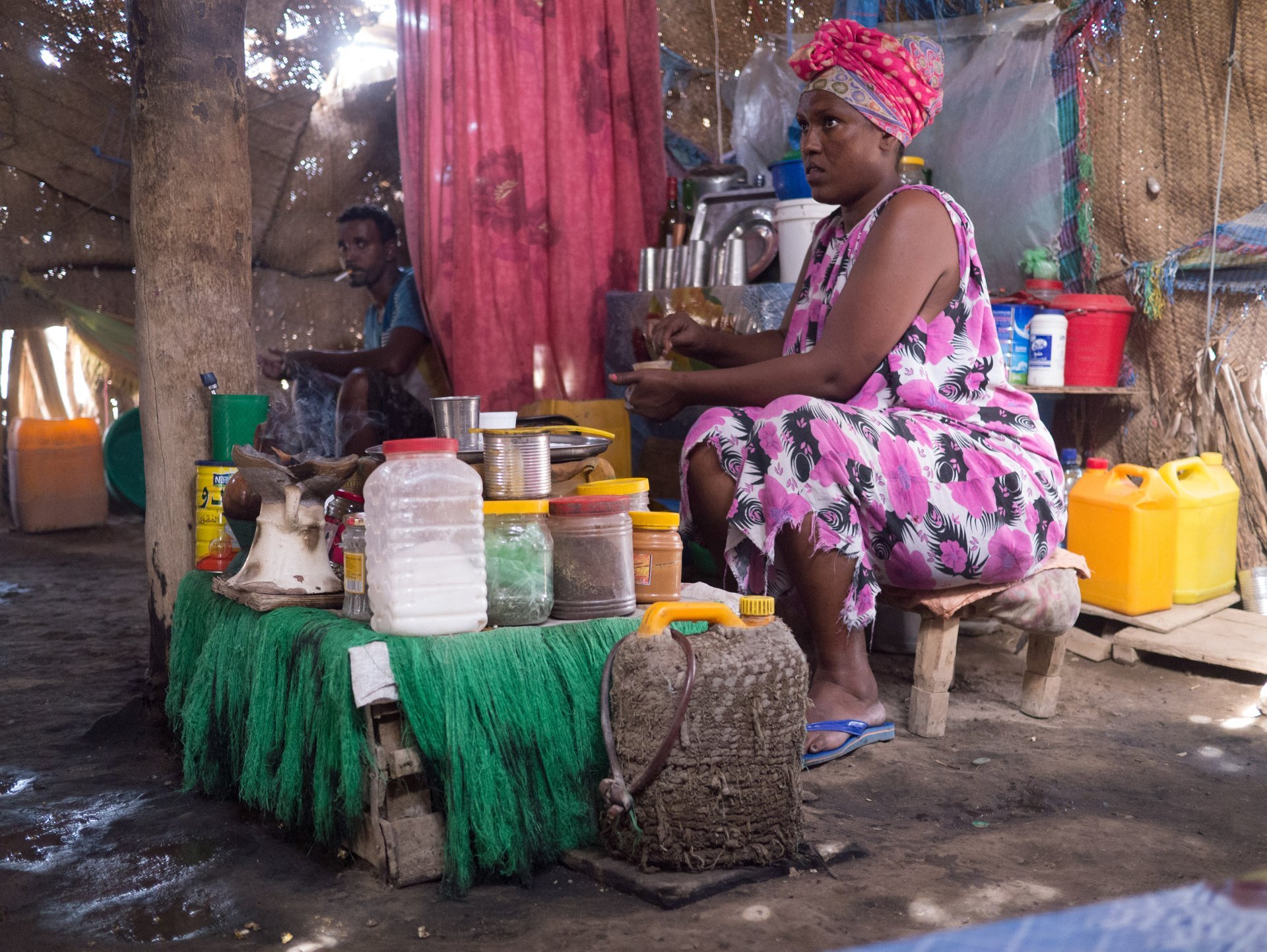
Home to the Afar ethnic group, the area is a center for traditional salt extraction, with merchants transporting minerals by camel caravans to Ethiopian highlands and Sudan. Producing nearly all of Ethiopia's salt, the region has long been known for its harsh conditions and the wary nature of its nomadic tribes, earning it the nickname "Gateway to Hell." Despite its challenges, the surreal landscapes, with their striking hues of white, yellow, green, and red from sulfur, iron oxide, and other minerals, continue to attract a few hundred adventurous visitors each year on guided expeditions.
Practical info
External resources
Find hotels and airbnbs near Danakil Depression (Map)
People interested