Patapat Viaduct in Philippines 2026-2027
Enjoy the ride along the 5th longest bridge in the Philippines
Best time: December–May
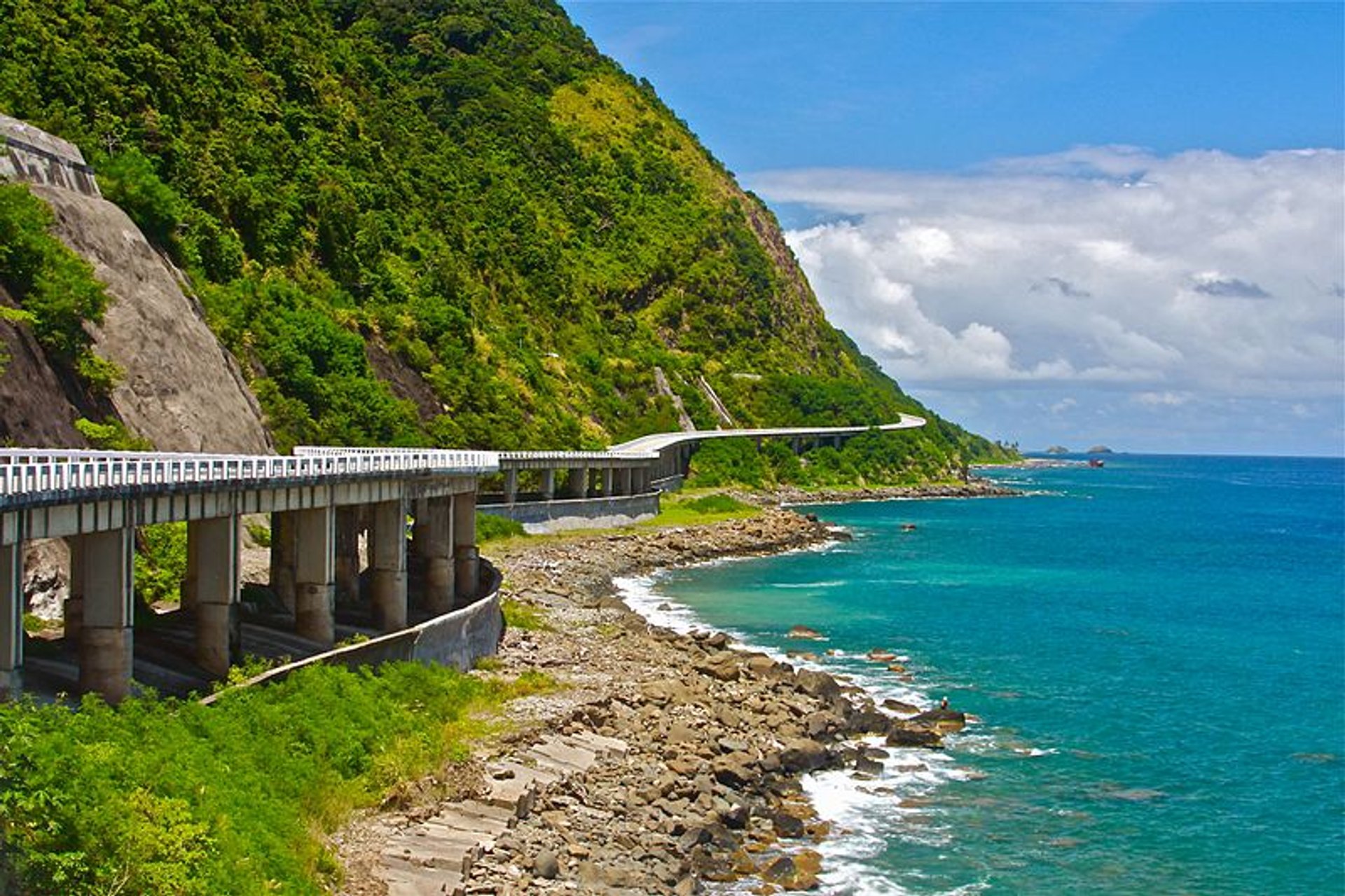


Patapat Viaduct is a stunning coastal bridge located in Pagudpud, Ilocos Norte, at the northern tip of Luzon Island in the Philippines. Stretching over a kilometer along the coastline, it connects the region's mountainous terrain with breathtaking views of the sea. Its picturesque setting has made it a popular spot for visitors exploring the natural beauty of northern Luzon.
Highlights
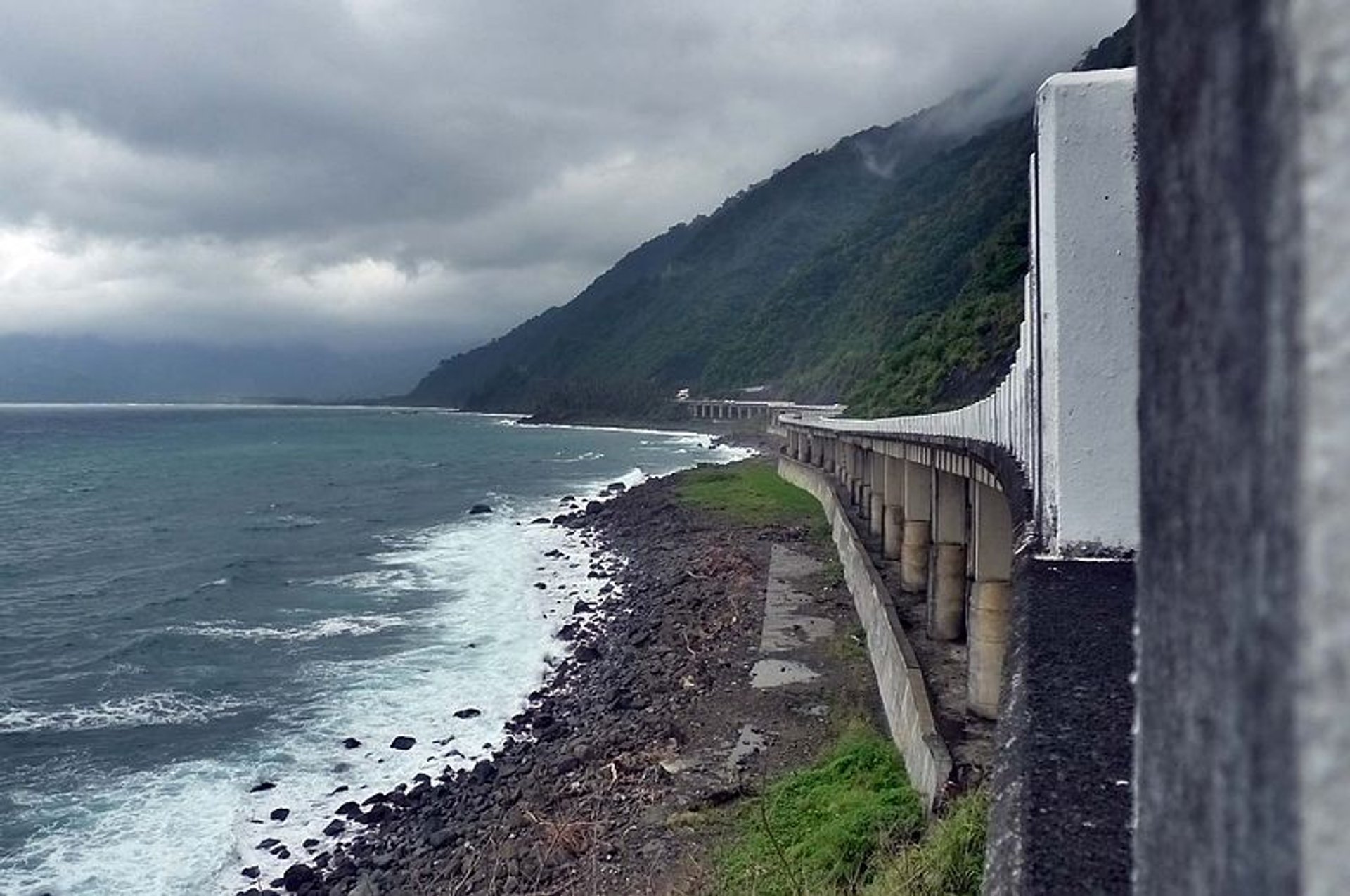
Built some 31 m (102 ft) above the seashore and stretching over 1.3 km (0.8 mi), this concrete coastal viaduct connects the Maharlika Highway from the Ilocos Region to the neighboring province Cagayan Valley. Moreover, it snakes around the coastal mountains, the starting point of the Cordillera Mountain Range, and is considered one of the longest bridges in the Philippines.
History
The local authorities decided to build Patapat Bridge to prevent landslides in the area, which caused vehicular accidents in the past. Finally, the viaduct was constructed by Hanil Development Co. Ltd. and opened to traffic in October 1986.
Tourist Attraction
Known for its one-of-a-kind panorama, Patapat Viaduct is a popular tourist attraction nowadays. Everyone can enjoy the picturesque view of Pasaleng Bay, along with a mini-hydro plant and the Mabugabog Falls. Pulling over at the side of the road is not forbidden so that visitors can take astonishing photos of the mountain and sea views.
Best Time to Visit
The best time to visit Patapat Viaduct in the Philippines is from December to May, during the dry season. This period offers clear skies and uninterrupted views of the stunning Calayan and Fuga islands. To make the most of your visit, check the weather forecast in advance to ensure favorable conditions. You might also plan your trip around local festivals or events in Ilocos Norte, which can add a vibrant cultural touch to your experience.
Getting There
Patapat Viaduct is located about 16 kilometers, or nearly an hour's drive, from Pagudpud, Ilocos Norte. To reach the viaduct from Pagudpud, head towards Cagayan, where you'll encounter scenic, winding roads. If you're starting from Laoag City, you can take any bus bound for Pagudpud. For those traveling from Manila, look for buses heading to Laoag City.
For a faster option, consider flying from Manila's Ninoy Aquino International Airport to Laoag City, the capital of Ilocos Norte. The flight takes approximately 1 hour and 15 minutes. Once in Laoag City, you can take a bus or van to Pagudpud, with a travel time of about 1.5 to 2 hours by land.