Best time to visit California

Sonora Pass in California

A beautiful drive in Sierra Nevada mountains

Best time: mid-May–mid-November

Sonora Pass
Sonora Pass
Sonora Pass
Sonora Pass

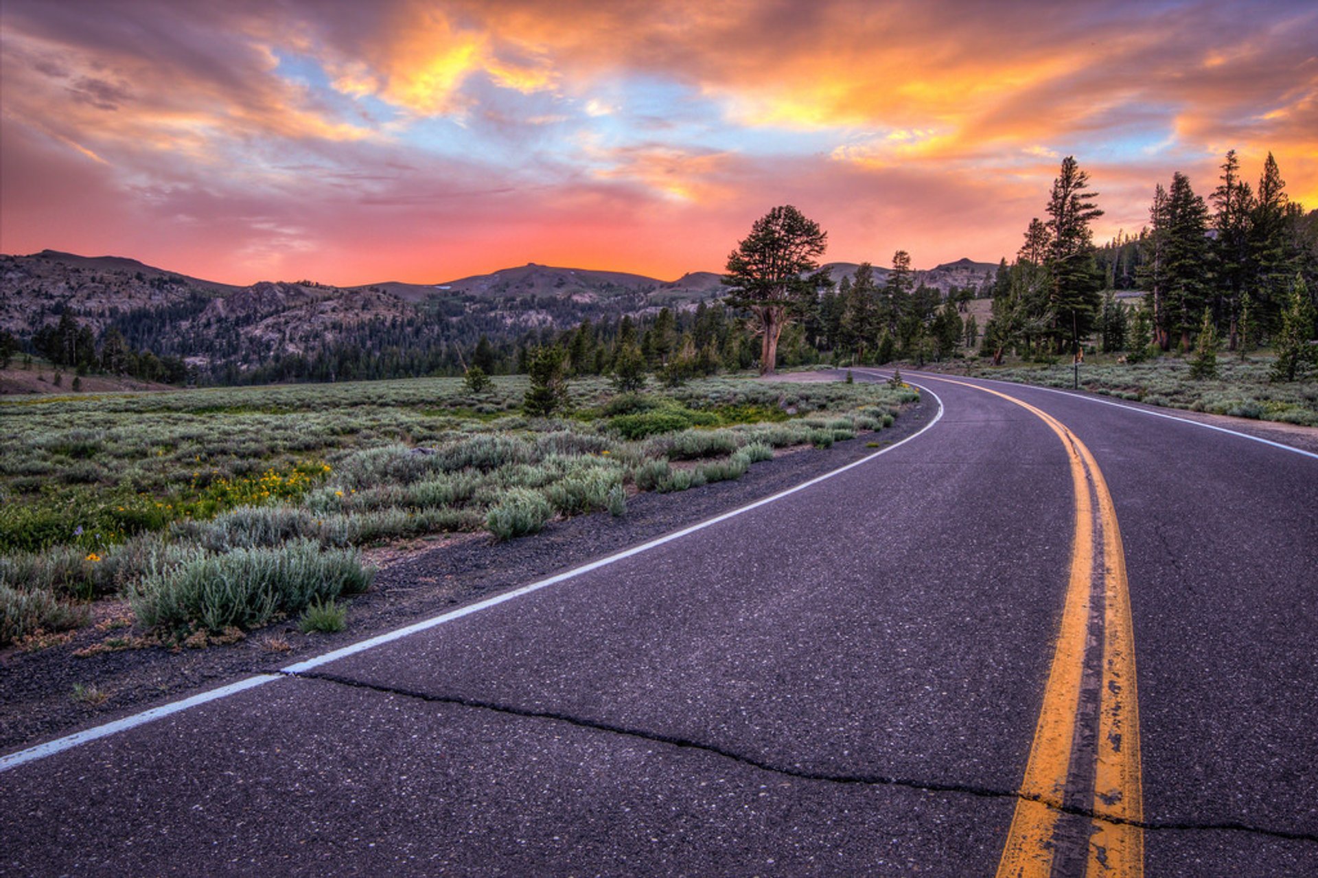
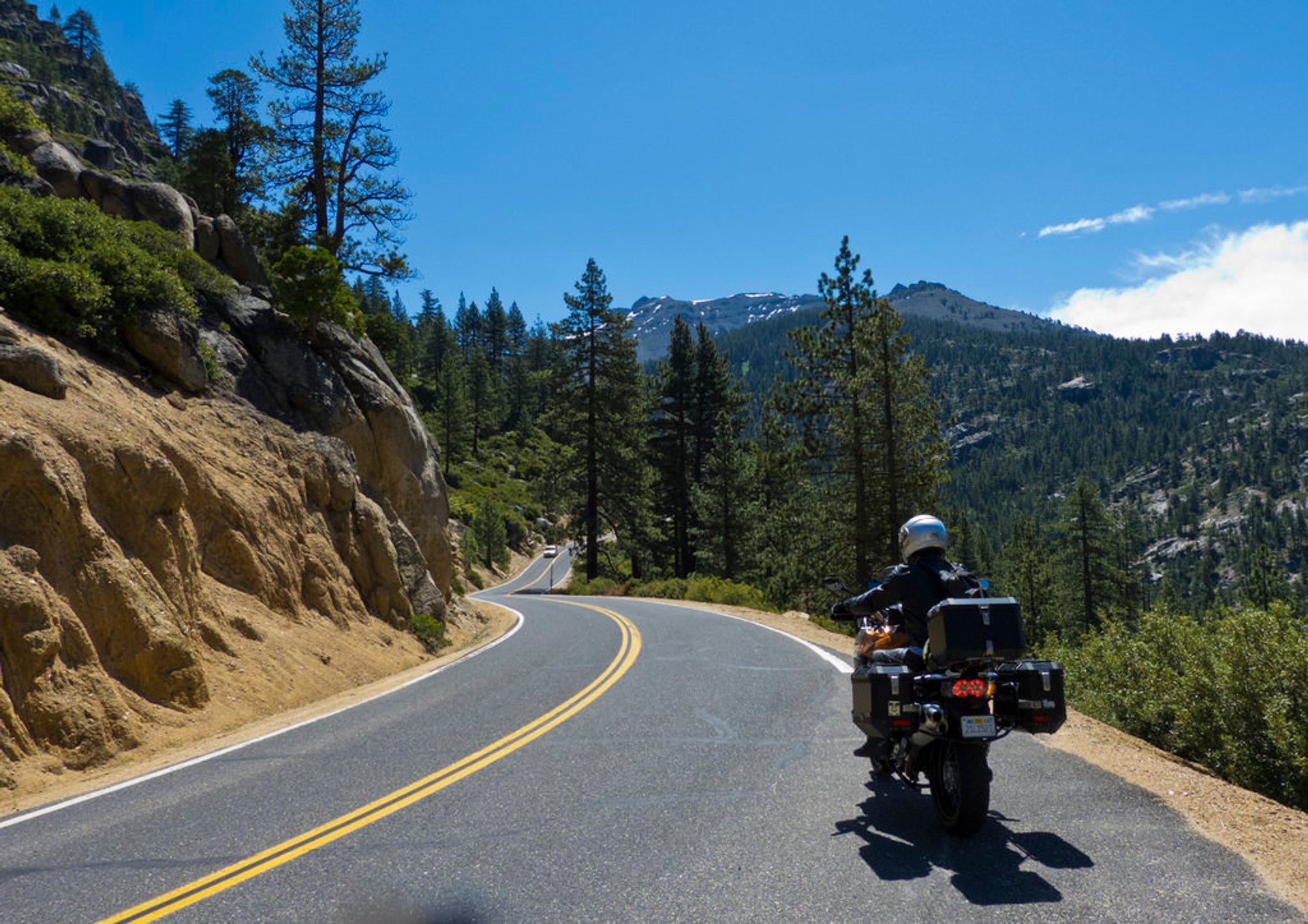
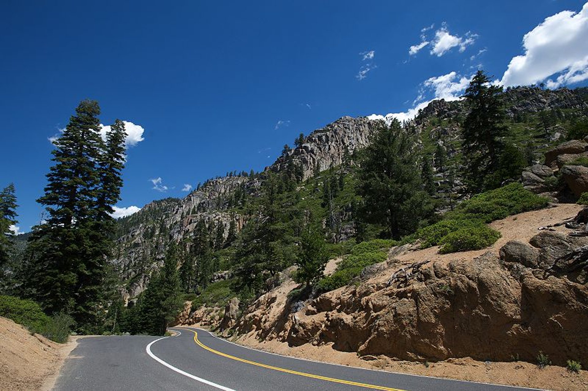
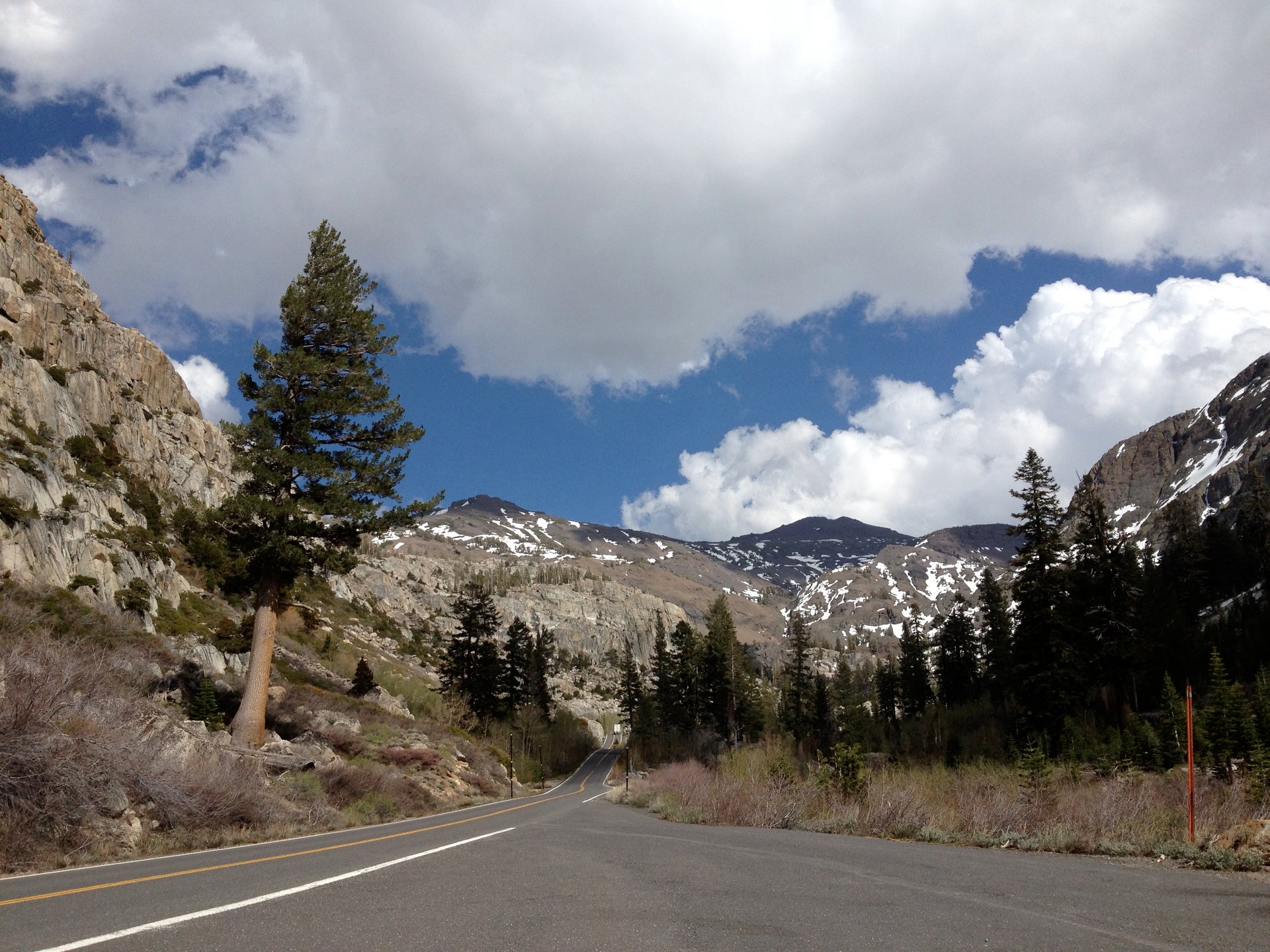
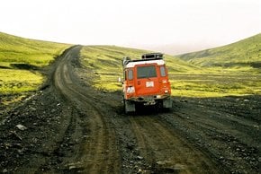
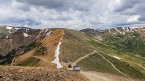
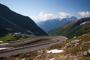
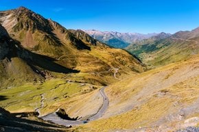
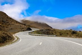
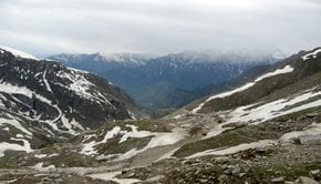
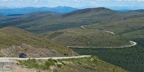
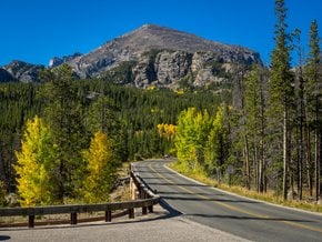
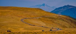
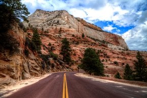
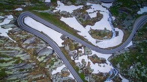
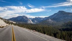
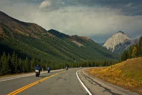
Sonora Pass is located in the mountains of Sierra Nevada, in Mono County, California. The asphalted road that traverses the pass—State Route 108—is one of the highest mountain roads in the state. Its peak elevation is 2.933 m (9,624 ft) above the sea level. This road is popular due to its scenic beauty, but it is also somewhat dangerous with sharp turns and blind spots. Sonora pass that links Sonora to the west and Bridgeport to the east is closed in winter, roughly between mid-November and mid-May, due to snow and ice. After the first heavy snowfalls, Sonora Pass becomes a haven for snowmobilers, snowshoers and cross country skiers. Wintersports fans can enjoy great snow conditions and challenging terrain in the Bridgeport Winter Recreation Area.

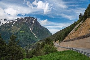
Summer activities along Sonora Pass include fishing, biking, horseback riding, hiking, and camping. There is a picnic at the top of the Sonora Pass on the Walker River featuring several tables, grills, and restrooms. Far-reaching views of Sierra Nevada range are guaranteed. Sonora Pass is part of The Pacific Crest Trail and National Scenic Trail. For those who want to spend the night in the mountains, there is a Sonora Bridge Campground open from June to September. Located on the West Walker River in a Jeffrey pine forest, the campground offers 23 camping spots for fishers and hikers.

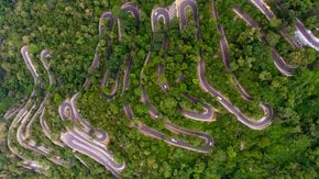
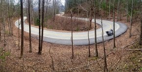
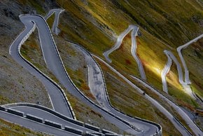
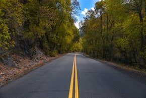
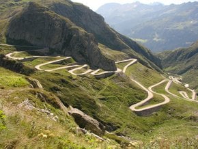
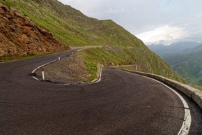
Some sections of Sonora Pass are very steep (about 26% grades). The narrow road winds between Kennedy Meadows on the west side and Leavitt Meadows on the east. The route is not for wide, heavy or long vehicles. Sonora Pass was a trade route as early as in 1852 by when a wagon train of Clark-Skidmore Company was taking immigrants through the mountains.

Practical info

When is the best time of year to visit Sonora Pass?

Visitors can make the most out of their trip to Sonora Pass by planning to arrive between mid-May to mid-November when the asphalted road is open. The warm climate during the peak season allows for exciting outdoor activities such as fishing, hiking, and camping to take place in the area and take advantage of its scenic beauty. Show more

Where is Sonora Pass located?

Taking a drive along State Route 108, travelers can experience the beauty of Sierra Nevada mountain range and must pass through Mono County, California, to arrive at Sonora Pass. Especially known for its steep difference in elevations, sharp turns, and beautiful views, this pass can be a challenging yet rewarding trip for many adventurists. Show more

What are the winter activities available near the pass?

During the months from mid-November to mid-May, the snowy area near Sonora Pass may be closed for any motorized vehicles, but winter sports enthusiasts have plenty of options to consider. Snowmobiling, cross-country skiing, and snowshoeing are popular activities enjoyed by many who appreciate the immense beauty of Bridgeport Winter Recreation Area. Show more

How many camping spots does the Sonora Bridge Campground offer?

Located in the Jeffrey Pine forest, Sonora Bridge Campground is a suitable place for visitors to stay for its 23 camping spots from June to September. Whether visitors are hikers or fishermen, they can appreciate the serene environment and beautiful scenery surrounding this area alongside the West Walker River, a natural attraction for trout fishermen. Show more

What are the dangers associated with driving Sonora Pass?

Being a road filled with sharp turns and blind spots, Sonora Pass can be risky for drivers of bigger or wider vehicles, or those driving on steep grades of up to 26%. Drivers should exercise extreme caution when driving in the area, especially during the winter months, when the road becomes inaccessible due to snow and ice. Show more

Ask a question
Last updated: by Eleonora Provozin