Stelvio Pass (Passo dello Stelvio) in Italy 2026
A popular cycling destination in the Ortler Alps
Best time: June–October


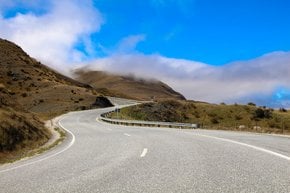
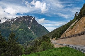
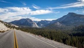
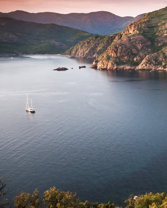
Nestled in the heart of the Eastern Alps, the Stelvio Pass (Passo dello Stelvio) is a renowned mountain pass that draws cyclists, motorcyclists, and adventurers from around the world. Known for its breathtaking scenery and challenging hairpin bends, the pass offers a blend of natural beauty, historical significance, and a variety of outdoor activities, from its challenging cycling routes to its summer skiing opportunities. While planning a visit, it's essential to check for current road conditions and event schedules to make the most of this iconic mountain pass.
Activities at Stelvio Pass
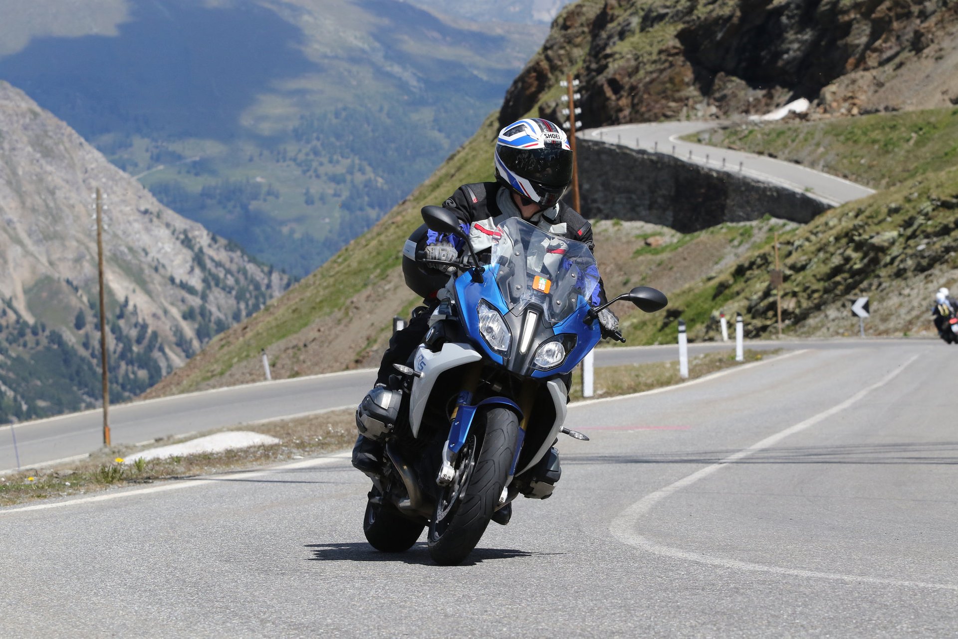
Cycling and Motorcycling
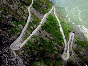
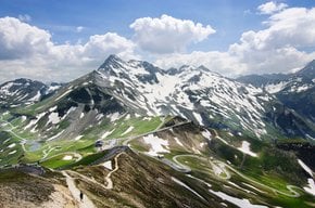
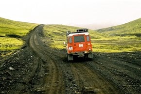
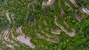
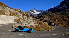
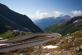
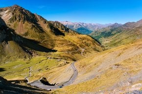
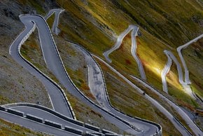
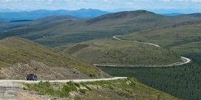
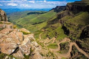
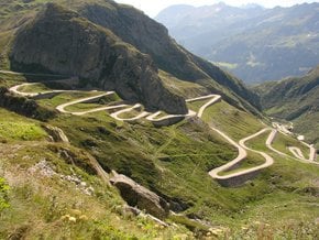
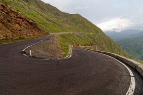
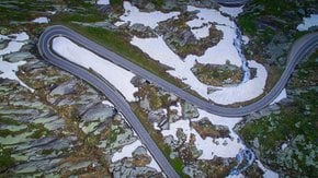
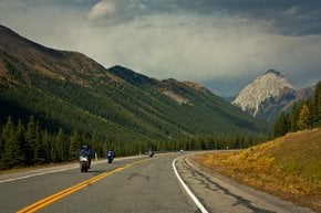
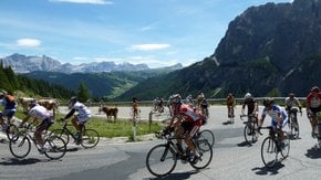
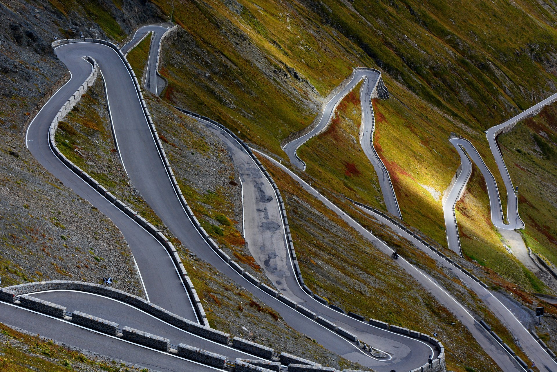
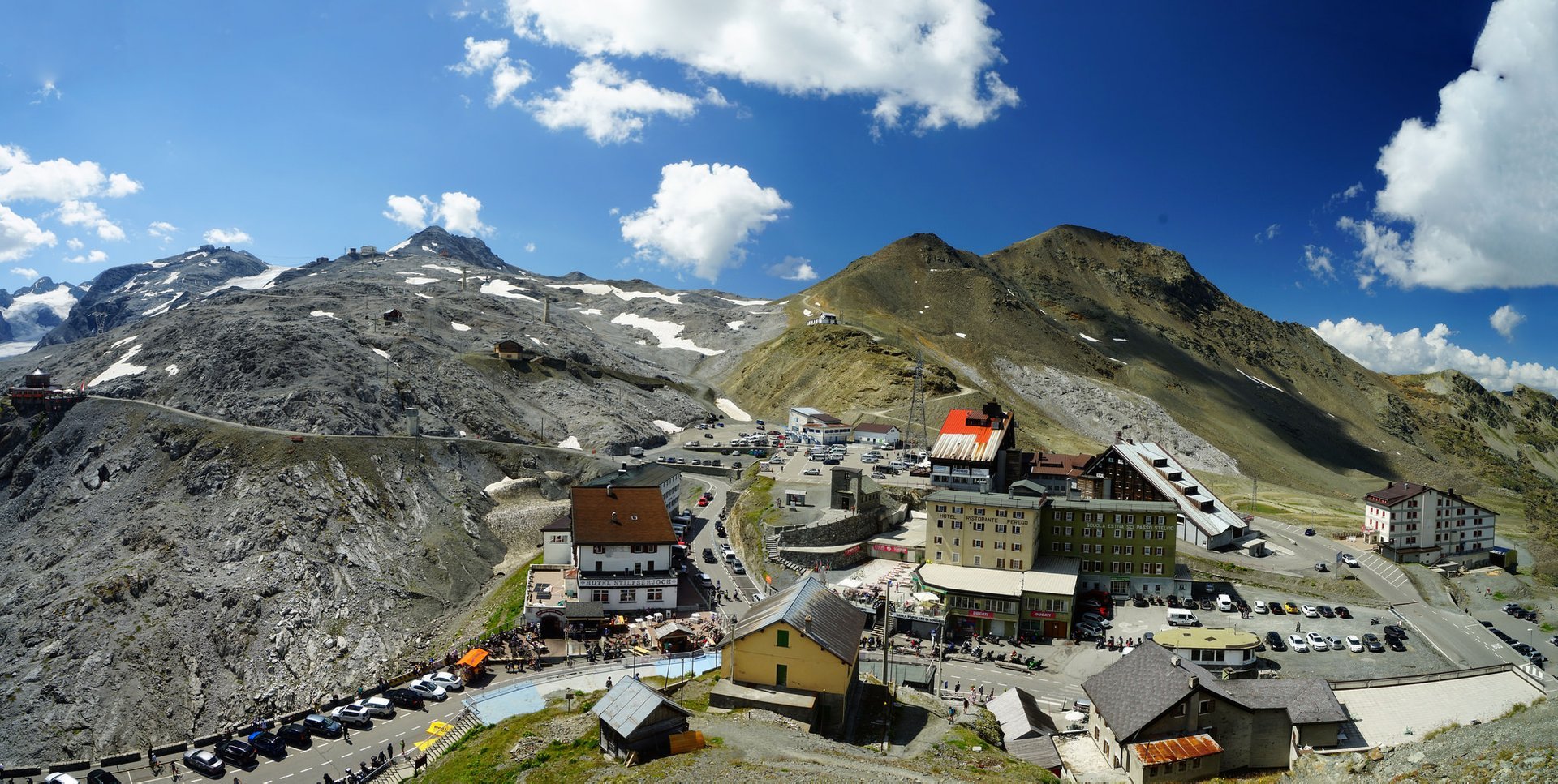
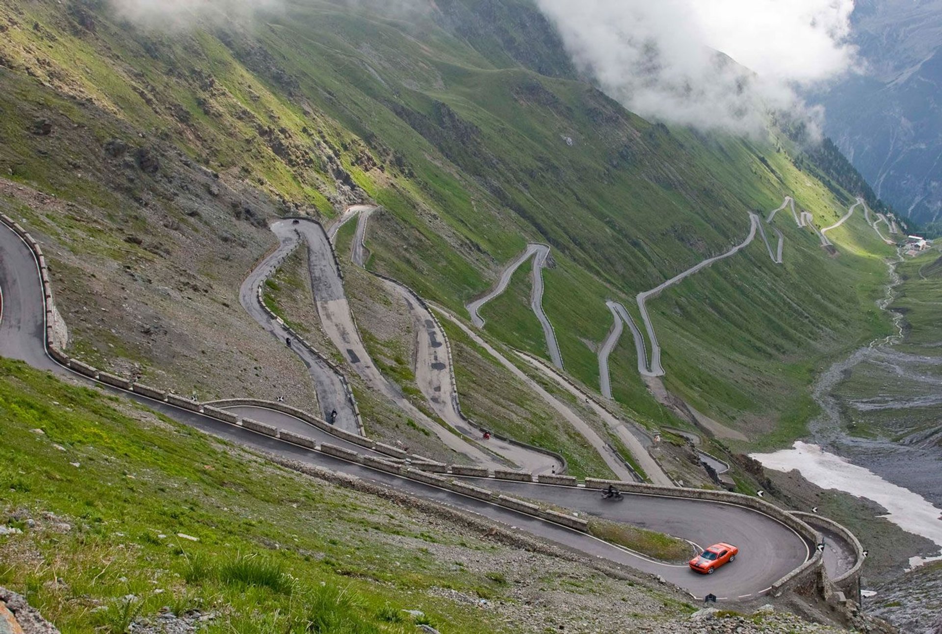
The Stelvio Pass is a premier destination for cyclists, largely due to its inclusion in the Giro d'Italia. The road SS38, which traverses the pass, features 48 hairpin turns and reaches an elevation of 9,045 feet (2,757 m). Cyclists and motorcyclists are drawn to these winding curves, which offer a challenging yet exhilarating experience. The pass is the highest paved mountain pass in Italy and the second highest in the Alps, making it a bucket-list item for many enthusiasts.
Summer Skiing
Summer skiing is another popular activity at Stelvio Pass. The nearby Livrio ski resort, accessible via a cable car, offers over 20 miles of slopes. Skiers can enjoy the pristine snow from early morning until late afternoon. The Stelvio Glacier, open from May to November, provides a high-altitude environment perfect for skiing and snowboarding even during the warmer months. As per the information provided, modern hotels in the area offer a range of amenities, including equipment rentals and ski instructors.
Hiking and Mountaineering
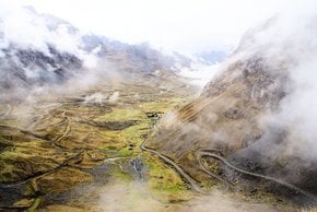
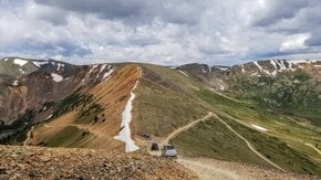
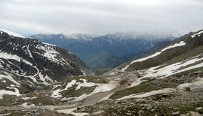
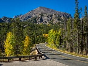
The Stelvio National Park offers numerous trails for hiking and mountaineering. Guided tours are available throughout the summer and spring, allowing enthusiasts to explore the unspoiled nature and scenic views. Visitors can admire nearby scenic peaks: Ortler, Thurwieserspitze, Trafoier Eiswand, Monte Scorluzzo, and Piz Umbrail. The park is also home to historical sites from World War I, including remnants of trenches and fortifications.
Seasonal Access and Events
Opening Times
The Stelvio Pass is typically open to traffic from June to October, depending on snow conditions. It usually closes around November 1 and reopens around June 1. The exact dates can vary based on weather, and travelers should check current conditions before planning a visit.
Granfondo dello Stelvio Santini
The Granfondo dello Stelvio Santini is a highly anticipated annual cycling event held in early June. Known for its rigorous routes, the event offers multiple courses of varying lengths and difficulties, catering to different skill levels. Cyclists can choose from three routes, all of which culminate in the iconic ascent to the Stelvio summit, providing a test of endurance and strength amidst breathtaking alpine scenery.
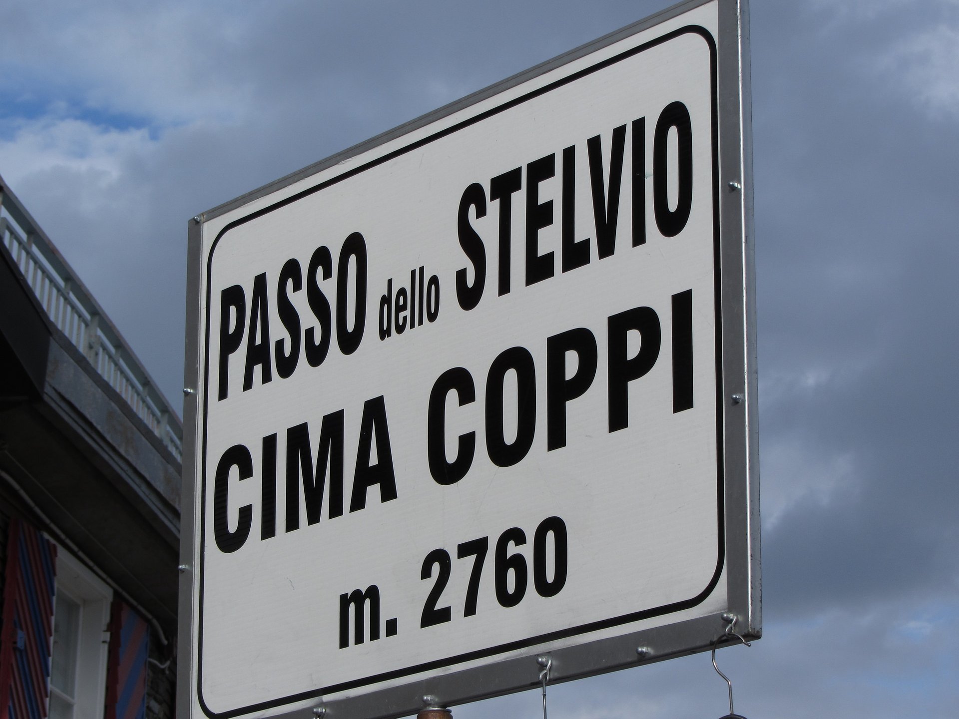
Stelvio Bike Day (Scalata Cima Coppi)
Stelvio Bike Day, also known as Scalata Cima Coppi, occurs annually on the last Saturday of August or the first Saturday of September. On this day, the pass is closed to motor traffic, allowing around 12,000 cyclists to take over the road. Participants can choose from three routes: the South Tyrolean route, the Lombardia route, and the Swiss route. This event highlights the pass's importance in the cycling community and offers a unique experience for riders.
Prices
Stelvio Pass is generally accessible to the public without any entry fee. However, parking fees and costs associated with specific activities, such as cable car rides and equipment rentals, can vary. The pricing for ski passes offers various options to accommodate different needs. A daily ski pass is priced at €56, with discounts available for children, seniors, and disabled persons. Multi-day passes and seasonal passes provide more economical choices.
Location and Infrastructure
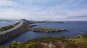
The Stelvio Pass connects the town of Bormio in Italy to Prato allo Stelvio in South Tyrol and extends towards the Swiss border. The nearest major city is Bolzano, located about 80 miles (130) km to the east. The pass is about 230 miles (370 km) from Milan and 220 miles (360 km) from Venice. Public transportation options, including buses, provide access to the pass, although many visitors prefer to drive due to the scenic routes.
History of Stelvio Pass
Construction and Early Use
The Stelvio Pass was constructed between 1820 and 1825 during the Austrian Empire to connect Lombardy with the Austrian Empire, specifically Tyrol. The construction, backed by Emperor Francis I of Austria, was a significant engineering feat at the time. The pass was designed by Carlo Donegani, a renowned engineer who meticulously planned the route. Initially, it served as a crucial link for military and commercial purposes.
World War I Significance
During World War I, the Stelvio Pass held strategic importance as the border between Austria and Italy. Fierce battles were fought in the area, and the remains of trenches and fortifications still dot the landscape. A monument on the Bormio side commemorates the 64 Italian soldiers who died here.
Modern-Day Fame
The Stelvio Pass gained modern fame through its inclusion in the Giro d'Italia. First featured in 1953, the pass quickly became legendary for its challenging ascent. Fausto Coppi's iconic climb during the Giro solidified its status as a must-ride for serious cyclists. The pass has appeared in the race multiple times and is often the highest point in the Giro, known as the Cima Coppi.
Practical info
Find hotels and airbnbs near Stelvio Pass (Passo dello Stelvio) (Map)
People interested