Best time to visit India

Mughal Road in India

A scenic and historic highway between high-altitude Jammu and Kashmir on the sides of the Pir Panjal Range

Best time: April–October

Mughal Road
Mughal Road

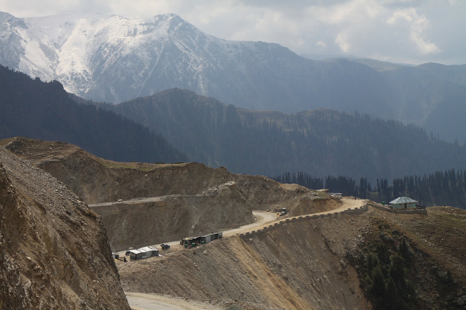
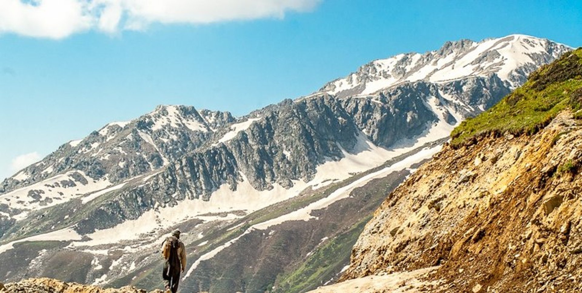
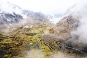
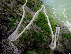
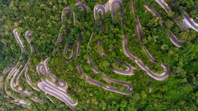
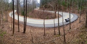
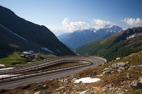
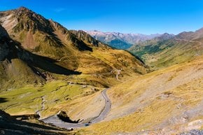
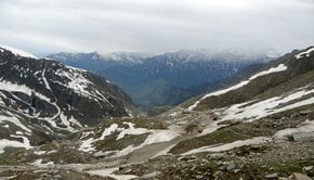
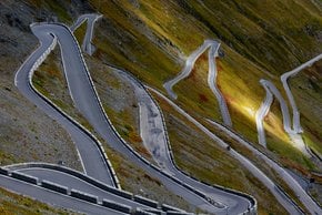
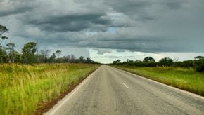
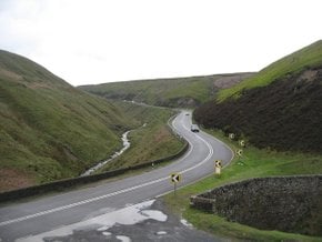
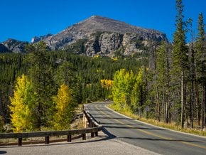
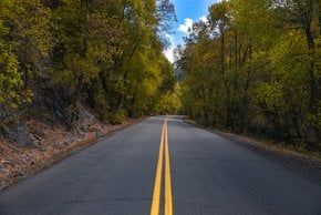
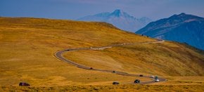
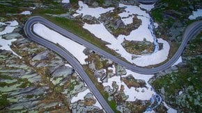
The Mughal Road is a beautiful, but difficult drive through Pir Panjal mountain range, in the state of Jammu and Kashmir. The 82.3-km (51-mi) long asphalted road connects Bafliaz, the Poonch district of Jammu, and the town of Shopian (Shupiyan), in the Kashmir Valley. The road winding through the mountains to its highest point the Pir Ki Gali Pass at 3,485 m (11,433 ft) above the sea level, features unbelievable hairpin twists, switchbacks, and stunning panoramic views in every direction. During the winter months, the road is often closed due to heavy snowfalls, so the best time to travel along the Mughal Road is from April to October.

Mughal Road was originally called the Old Imperial Road or Namak Road, which means salt route. In the 16th century, Mughal emperors used it to conquer Kashmir. The modern paved road was built between the 1950s and 1970s. In 2005 it was reconstructed into a broad highway that is safe to ride. Visitors can see many historical Mughal monuments along the way. The road also passes many interesting towns—Bafliaz (Buffliaz), Behramgalla, Chandigarh, Poshana, Chattapani, Peer Ki Gali, Aliabad, Zaznar, Dubjan, Hirpora, and Shopian.

Mughal Road is not very busy, so you won't see much traffic. It's also almost untouched by commerce so visitors can enjoy beautiful vistas and imagine what it looked like during the Mughal emperors times. Security on Mughal Road is rather tight so be prepared to show your documents and car papers. You will need to register your vehicle when traveling on this road.

Practical info

When should travelers plan a visit to Mughal Road in India?

Visiting Mughal Road between April and October is advisable as this period has favorable weather conditions for navigating the Pir Panjal mountain range. The road is closed during the winter due to heavy snowfall, making it unsafe to drive. Show more

What are the starting and ending points of the 82.3 km road in India called Mughal Road?

Mughal Road, an 82.3 km long highway, connects Bafliaz in Poonch district of Jammu with Shopian in Kashmir valley. The road's highest point is Pir Ki Gali Pass, sitting at an elevation of 3,485 m above sea level. The route offers stunning panoramic views and hairpin twists. Show more

What led to the naming of 'Namak Road' and what is significant about it?

Namak Road, now called Mughal Road, is known as the salt route in Urdu. The roots of its name stem from the salt trade that Muhandis would undertake around the 16th century. During that time, it was used by the Mughal emperors as a path to capture Kashmir. The name signifies the trade that took place between Poonch Rajouri and the Kashmir Valley. Show more

Visitors interested in history along the Mughal Road can check which monuments and towns?

Mughal Road passes through several Mughal historical sites and towns. Visitors can explore Chingus Fort, which was built by Mughal Emperor Jahangir over 400 years ago, as well as Srinsagar and its environs. They can also discover Chhatru Fort in Rajouri and Noor Mahal Palace in Poonch, among other impressive sites like Hirpora Wildlife Sanctuary and Nandansar and Sukhsar lakes. Show more

Are there any security concerns for travelers along Mughal Road, and what travel documents are mandatory?

Travelers planning to drive on Mughal Road should expect tight security and be prepared to produce mandatory documents and car papers. The region is heavily militarized due to persistent tension between India and Pakistan. Visitors must first register their cars before embarking on the trip. Despite less traffic on the road, visitors should exercise caution and check the situation before booking their trip. Show more

Ask a question

Find hotels and airbnbs near Mughal Road (Map)

Last updated:
Authors: Olha Savych